1
Village community centre and children's playground, Hollybush
Accessed from Banalog Terrace above the A4048 Newport Road.
Image: © Jaggery
Taken: 23 May 2017
0.00 miles
2
Hollybush Community Centre
The hall is accessed from the A4048 Newport Road via Banalog Terrace. The yellow marked area near the door is reserved for the vehicle of a blue badge holder. The Community Centre was built in 2007 with a grant from several local organisations and the support of a local business. The centre is managed by the Hollybush Residents Association, a registered charity. The hall has a capacity of 60. The meeting room is suitable for up to 12 people.
Image: © Jaggery
Taken: 23 May 2017
0.00 miles
3
Hollybush playground
Children's playground in Banalog Terrace, on the east side of Hollybush Community Centre. http://www.geograph.org.uk/photo/5401751
Image: © Jaggery
Taken: 23 May 2017
0.01 miles
4
Farm access road, Hollybush
Viewed from the corner of Banalog Terrace and Llwyn Bach Terrace.
The name sign on the right shows LLWYN BACH FARM.
Image: © Jaggery
Taken: 23 May 2017
0.02 miles
5
Yellow gate at a playground entrance, Banalog Terrace, Hollybush
Hollybush Community Centre http://www.geograph.org.uk/photo/5401751 is behind the playground.
Image: © Jaggery
Taken: 23 May 2017
0.02 miles
6
Fork in the road, Hollybush
The left fork leads to the Community Centre. http://www.geograph.org.uk/photo/5401751
The right fork leads to a recreation ground.
Image: © Jaggery
Taken: 23 May 2017
0.02 miles
7
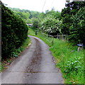
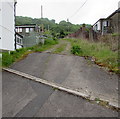
Deteriorating road surface, Hollybush
The surface of this side road ascending from Newport Road towards Banalog Terrace resembles a track ahead.
Image: © Jaggery
Taken: 23 May 2017
0.04 miles
8
Steps to Hollybush
Image: © Alan Hughes
Taken: 24 Feb 2024
0.04 miles
9
Detached houses, Banalog Terrace, Hollybush
Houses above Newport Road, the main road through the village.
Image: © Jaggery
Taken: 23 May 2017
0.04 miles
10
Lockup garages, Hollybush
Located alongside a side road above Newport Road and below Banalog Terrace.
Image: © Jaggery
Taken: 23 May 2017
0.06 miles


