1
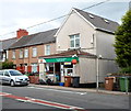
Underwood Road, Penmaen
Image: © Roger Cornfoot
Taken: 10 May 2007
0.07 miles
2
Oakdale Recreation Ground south
Edge of playing field; the houses are on Farm Close.
Image: © M J Roscoe
Taken: 29 Oct 2015
0.11 miles
3
Beech tree, rear of Farm Close, Oakdale
Beech tree, with oak tree to its left, on the edge of Oakdale Recreation Ground; see
Image for an autumnal view.
Image: © M J Roscoe
Taken: 14 Jun 2017
0.11 miles
4
Roger Lewis Woodland Garden, Oakdale
Path from entrance
Image to garden, renovated in 2007-2008, a public green space. In 2015 it won a Green Flag Community Award.
Image: © M J Roscoe
Taken: 14 Mar 2016
0.11 miles
5
Cherry Tree, Oakdale Recreation Ground
Tree is on the edge of the small car park, overhanging the bowling green enclosure. The housing estate, then under construction, is on what were allotments.
Image: © M J Roscoe
Taken: 10 May 2010
0.12 miles
6
Recreation Ground, Oakdale
Edge of the sports field with the playground
Image beyond, and beyond the stone wall the green pavilion.
Image: © M J Roscoe
Taken: 14 Jun 2017
0.13 miles
7
Main entrance, Roger Lewis Woodland Garden, Oakdale
The woodland once formed part of Penmaen House farm and much of it was planted in the 19th century by the farm's owner, Roger Lewis. By the 1970s only the present area remained in a deteriorated state.In 2007, with the aid of various grants, the area was improved mainly by thinning non native trees, planting many native saplings, laying a meandering path and constructing new gates. The garden was officially opened in 2008, and has since won various 'green' awards.
Image: © M J Roscoe
Taken: 14 Mar 2016
0.14 miles
8
Playground, Oakdale Recreation Ground
Viewed from a ramp in the skate park. The green building on the left is the pavilion. The site is maintained by the local council.
Image: © M J Roscoe
Taken: 29 Oct 2015
0.14 miles
9
Northern boundary of Penmaen
Viewed from Oakdale. Penmaen is a village in Caerphilly county borough.
Ahead on the left is the Groveside Road junction.
Image: © Jaggery
Taken: 8 Aug 2012
0.14 miles
10
Penmaen Post Office
Located alongside Penmaen Road in number 1, Penmaen Villas.
Image: © Jaggery
Taken: 8 Aug 2012
0.15 miles


