1
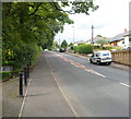
Parkview Bungalows, Penmaen
Former B4251 road from Oakdale to Pontllanfraith; the edge of Woodfield Park is on the right.
Image: © M J Roscoe
Taken: 16 Jun 2016
0.03 miles
2
Main road through Penmaen
Viewed from the entrance to Lower Lodge. The road heads north past bungalows on the right and Woodfield Park on the left. The village of Oakdale is ahead.
Image: © Jaggery
Taken: 8 Aug 2012
0.05 miles
3
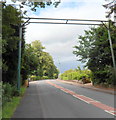
Bat bridge, Penmaen
The bat bridge is a pole on either site of the road with a line of netting run between them.
It was installed here, across the main road through Penmaen, in 2004.
Bats don't fly in the open, but usually follow hedge and tree lines. Even something as apparently trivial as the removal of a hedge can disrupt their flight. Bats stay in vegetation to avoid predators, crossing roads at points where trees either side create a canopy, as here.
The need for the bat bridge arose following the demolition of a nearby old railway bridge, part of a bat route, during the building of Sirhowy Enterprise Way.
Image: © Jaggery
Taken: 8 Aug 2012
0.05 miles
4
Entrance drive to Woodfield Park Funeral Home, Penmaen
Viewed across the main road through Penmaen. The funeral home is about 200 metres away.
Image: © Jaggery
Taken: 8 Aug 2012
0.06 miles
5
Building site in Woodfield Park
Construction of new housing estate on what was a meadow of significance for wildlife.
Image: © M J Roscoe
Taken: 1 Jan 2019
0.11 miles
6
A4048 heads NW towards Blackwood from Pontllanfraith
This section of the A4048 was formerly the route of a railway line.
As with other recently built major roads http://www.geograph.org.uk/photo/3074149 in the area, pedestrians must not proceed
beyond the red-edged circular sign containing a black silhouette of a person.
Image: © Jaggery
Taken: 8 Aug 2012
0.12 miles
7
Bus stop and bat crossing, Oakdale Terrace, Penmaen
With the construction of the nearby Sirhowy Enterprise Way, several bat crossings were constructed in the area to mitigate for the loss of an old railway bridge.
Image: © Robin Drayton
Taken: 5 Apr 2008
0.14 miles
8
Pasture east of Penmaen farmyard
Field, with Mynyddislwyn across the valley.
Image: © M J Roscoe
Taken: 14 Mar 2016
0.15 miles
9
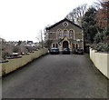
Former church or chapel in Woodfieldside, Blackwood
Viewed from St David's Avenue in February 2014. United Reformed Church (Wales) Trust notices nearby show KEEP OUT - POTENTIAL DANGER Maintenance work in progress, though that warning probably applies to the adjacent churchyard. I saw no other churches, former or in use, in St David's Avenue today, so it's likely that this used to be St David's church.
Image: © Jaggery
Taken: 18 Feb 2014
0.15 miles
10
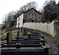
Churchyard and former church, Woodfieldside, Blackwood
Viewed from the edge of St David's Avenue. There is no name on the former church. http://www.geograph.org.uk/photo/4550356 I saw no other churches, former or in use, in St David's Avenue today, so it's likely that this used to be St David's church.
Image: © Jaggery
Taken: 18 Feb 2014
0.15 miles


