1
Houses, High Street, Argoed
Houses on the east side of High Street, Argoed.
Argoed is a small village in the Sirhowy Valley, close to Blackwood.
Image: © Jaggery
Taken: 1 Mar 2010
0.04 miles
2
Argoed Garage
Vehicle servicing garage and MOT test centre, located on High Street, Argoed.
Image: © Jaggery
Taken: 1 Mar 2010
0.04 miles
3
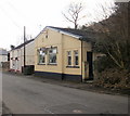
Argoed Reform Club
This is the northernmost building on High Street, which continues northwards (beyond the right edge of the photo) for about 200 metres through a wooded area before ending at the junction with the A4048.
Image: © Jaggery
Taken: 1 Mar 2010
0.06 miles
4
High Street, Argoed
This was once the main road through the Sirhowy Valley.
Most of the village is now bypassed by the A4048 which runs along the hillside on the left of this view.
Image: © Robin Drayton
Taken: 30 Jul 2010
0.06 miles
5
New Road, Argoed
Image: © Colin Pyle
Taken: 2 Jan 2012
0.07 miles
6
Argoed post office
The Post Office in Argoed High Street. There is a for sale sign on the building.
Image: © Sally Lloyd
Taken: 5 Jul 2007
0.07 miles
7
Argoed Reform Club, High Street, Argoed
Image: © Ian S
Taken: 25 May 2014
0.08 miles
8
Steps to New Road, Argoed
Flight of wooden steps from small playing field down through bushes to building on New Road
Image: © M J Roscoe
Taken: 20 Jul 2016
0.08 miles
9
Looking down the south end of High Street, Argoed
This appears to be a country road, yet it is the southern end of High Street, Argoed as it descends from the A4048. Beyond the right edge of the photo, the land descends steeply to the Sirhowy valley.
http://www.geograph.org.uk/photo/1731236 to a view from the opposite direction.
Image: © Jaggery
Taken: 1 Mar 2010
0.08 miles
10
National Cycle Route 467, 'Argoed Station'
Looking south towards Blackwood at an access point near the site of the former Argoed Station. The cycle route is on the former railway trackbed, and runs parallel with the High Street, Argoed here.
Image: © M J Roscoe
Taken: 5 Oct 2016
0.09 miles


