1
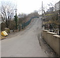
New Road houses, Argoed
Houses on the west side of New Road (A4048). The land on the east side descends steeply to the Sirhowy valley.
Image: © Jaggery
Taken: 1 Mar 2010
0.18 miles
2
Field at Argoed Uchaf Farm
Looking across the Sirhowy Valley towards the new Islwyn High School, centre.
Image: © M J Roscoe
Taken: 20 Jul 2016
0.18 miles
3
The A4048 at Argoed
Image: © Ian S
Taken: 25 May 2014
0.20 miles
4
Upper James Street, Argoed
Looking down Upper James Street towards the Sirhowy river, and the steeply-rising land on the other side of the river. The distant half of the terrace is Lower James Street. http://www.geograph.org.uk/photo/1734924
Image: © Jaggery
Taken: 1 Mar 2010
0.21 miles
5
Stables, Sunny View, Argoed
Stables and trotting equipment in paddock, viewed from gate on ramp off minor road.
Image: © M J Roscoe
Taken: 20 Jul 2016
0.21 miles
6
High Street Argoed climbs towards the A4048
The view up High Street from the junction with Cwm Road. Despite its name, this is
more like a country road than a high street. On the left side, the land descends steeply towards the Sirhowy valley.
http://www.geograph.org.uk/photo/1731250 to a view in the opposite direction.
Image: © Jaggery
Taken: 1 Mar 2010
0.21 miles
7
'Arrow-slit' window filled in
This window is in the wall of the barn of Tynewydd which has been converted into a house. It is on the wall alongside the road.
Image: © Jessica Aidley
Taken: 5 Jul 2007
0.22 miles
8
Tynewydd converted barns.
This is part of a group of houses which appear to have been developed from a farm. Note the row of holes on the front of the closest building which appear to be the remains of an old dove-cote. The 'front' of this house is the end of what was once a large barn which had its main opening on the road to the right of this picture.
Image: © Jessica Aidley
Taken: 5 Jul 2007
0.22 miles
9
River Sirhowy below cliff, Cwm-corrwg
Looking downstream; this is probably the only cliff on the River Sirhowy.
Image: © M J Roscoe
Taken: 15 Oct 2015
0.23 miles
10
Footpath gate and cows
Metal gate to public field footpath from Heol Tynewydd to Cwm Crach. The gate appears to be a relic of a bygone age.
Image: © M J Roscoe
Taken: 20 Jul 2016
0.23 miles


