1
Ordnance Survey Cut Mark
This OS cut mark can be found on the wall of NO5 Twyncarn Terrace. It marks a point 91.483m above mean sea level.
Image: © Adrian Dust
Taken: 11 May 2019
0.01 miles
2
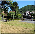
Cwmcarn from above (2)
Viewed from a high point on Cwmcarn Forest Drive, the long row of terraced houses next to the playing field is Feeder Row
Image The Raven Walk runs alongside the playing field.
Image: © M J Roscoe
Taken: 31 Mar 2017
0.02 miles
3
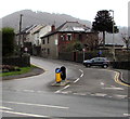
Road towards the centre of Cwmcarn
The B4591 Newport Road ascends into Cwmcarn.
Beyond the car on the corner of Feeder Row, the speed limit drops to 20mph.
The road on the lower left leads to the A467 which bypasses most of Cwmcarn.
Image: © Jaggery
Taken: 20 Dec 2016
0.02 miles
4
Newport Road telecomms cabinet, Cwmcarn
Viewed across the B4591 Newport Road in late December 2016.
A notice on the cabinet states that fibre broadband is here.
Image: © Jaggery
Taken: 29 Dec 2016
0.04 miles
5
Cwrt Twyncarn, Cwmcarn
Built in 2009, Cwrt Twyncarn contains 32 1- and 2-bedroom apartments for people aged at least 55. Located on the west side of Newport Road (B4591).
Image: © Jaggery
Taken: 7 Feb 2011
0.05 miles
6
Feeder Row, Cwmcarn
A cul-de-sac of well maintained terraced houses overlooking a playing field. The road forms part of the Raven Walk.
Image: © M J Roscoe
Taken: 31 Mar 2017
0.05 miles
7
B4591 junction at the southern edge of Cwmcarn
On the right, the B4591 Twyncarn Road heads towards central Cwmcarn.
The road to the left heads towards the A467.
Image: © Jaggery
Taken: 22 Jun 2018
0.05 miles
8
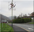
Pontywaun Christmas decoration at the edge of Cwmcarn
On December 20th 2016, a depiction of a skiing Father Christmas is on a lamppost alongside the B4591 Twyncarn Road near the Pontywaun and Cwmcarn boundary signs.
Image: © Jaggery
Taken: 20 Dec 2016
0.06 miles
9
Start of the 30 Zone at the edge of Cwmcarn
The 50mph speed limit on the A467 behind the camera drops to 30mph on the slip road to the B4591 in Cwmcarn. The A467 Clearway restrictions (no stopping except in an emergency or traffic jam) end here.
Image: © Jaggery
Taken: 20 Dec 2016
0.06 miles
10
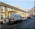
Centregreat van with a Versalift, Newport Road, Cwmcarn
The van has a Versalift, an access platform which can be extended for working high above street level, such as on street lights.
Image: © Jaggery
Taken: 29 Dec 2016
0.06 miles


