1
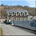
Sardis Community Chapel, Ynysddu
This venue is shared by the United Reformed and Presbyterian churches.
Image: © Roger Cornfoot
Taken: 10 May 2007
0.03 miles
2
Sardis Community Chapel, Ynysddu
Built in 1909.
Combined use by the Presbyterian Church of Wales and United Reformed Church.
Image: © Robin Drayton
Taken: 20 Mar 2010
0.03 miles
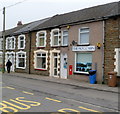
3
High Street houses, Ynysddu
Ynysddu's High Street is mainly residential, with only a few shops.
Image: © Jaggery
Taken: 7 Apr 2011
0.04 miles
4
Sardis Community Chapel, Ynysddu
Located on an unnamed side street on the south side of High Street. Built as a school house in 1909, the building is now Sardis Community Chapel. http://www.geograph.org.uk/photo/429398 to a view from the opposite side.
Image: © Jaggery
Taken: 7 Apr 2011
0.04 miles
5
Sardis Community Chapel Hall, Ynysddu
On the corner of High Street and an unnamed side road, next to Sardis Community Chapel.http://www.geograph.org.uk/photo/2841213
The green wooden building is sometimes referred to locally as the ambulance hall because it was formerly used by St John Ambulance for training.
Image: © Jaggery
Taken: 7 Apr 2011
0.04 miles
6
The Mog Cabin, Ynysddu
General store at 27 High Street. The red postbox in the wall is a reminder that this was formerly Ynysddu's post office.
Image: © Jaggery
Taken: 14 Mar 2012
0.04 miles
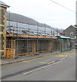
7
Rebuild for Sardis Community Chapel Hall, Ynysddu
This March 2012 view across High Street shows work in progress in the rebuilding of the hall.
Here's http://www.geograph.org.uk/photo/2841218 how it looked in April 2011.
Image: © Jaggery
Taken: 14 Mar 2012
0.04 miles
8
Ordnance Survey Cut Mark
This OS cut mark can be found on the NW face of the school. It marks a point 98.899m above mean sea level.
Image: © Adrian Dust
Taken: 23 Jun 2021
0.04 miles
9
Telephone exchange, Ynysddu
There was no identifying name board on this single-storey building at the southern end of High Street. It is shown on one map as a telephone exchange.
Image: © Jaggery
Taken: 7 Apr 2011
0.05 miles
10
Ynysddu Telephone Exchange
Located near the southern end of High Street. A large BT name board has appeared on the building since this view http://www.geograph.org.uk/photo/2841250 taken 11 months earlier, in April 2011. Another difference is that the lamp post has had a sign fixed to it.
Image: © Jaggery
Taken: 14 Mar 2012
0.05 miles


