1
Footpath steps, Ynys Hywel Activity Centre
The diamond shaped sign on the post indicates that this is part of the Raven Walk. The path leads up from the activity centre building towards the Ynys Hywel Camping Barn
Image
Image: © M J Roscoe
Taken: 3 Nov 2016
0.02 miles
2
Ynys Hywel Camping Barn
Overnight camping barn in the Sirhowy Valley Country Park; opened in 1988, it was the first camping barn in South Wales, but is now little used. The Sirhowy Valley and Raven Walks go past the front door.
Image: © M J Roscoe
Taken: 3 Nov 2016
0.04 miles
3
NCN 47 in the Sirhowy Valley
Tarmac path makes for an easy walk/cycle along an old railway. The leaves betray the time of year.
Image: © John Light
Taken: 14 Nov 2012
0.07 miles
4
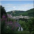
View of Cwmfelinfach
Ynys Hywel Countryside Centre can be seen in the foreground.
Image: © Kev Griffin
Taken: 25 Jul 2009
0.08 miles
5
Shared path in Sirhowy Valley Country Park
Image: © David Smith
Taken: 27 Sep 2021
0.08 miles
6
Road from Cwmfelinfach to Sirhowy Valley Country Park
The road heads south past the edge of allotments on the right. Ahead, the road makes a 90-degree turn, to continue along the north bank of the Sirhowy and thence into Sirhowy Valley Country Park.
On the right are wisps of smoke from an allotment bonfire. http://www.geograph.org.uk/photo/2836394
Image: © Jaggery
Taken: 7 Apr 2011
0.12 miles
7
Path down to Ynys Hywel Camping Barn
A grass footpath, recently cleared of encroaching vegetation, above Cwmfelinfach, a field for pigs on the left and woodland to the right.
Image: © M J Roscoe
Taken: 3 Nov 2016
0.12 miles
8
Babell Chapel Cwmfelinfach
This old chapel is situated just beyond Melin Street in Cwmfelinfach
Now disused, the chapel cemetery contains the remains of a well-known Welsh poet.
Up to the 1950s, a terraced row of small cottages, Babell Row, ran from close to the chapel in an easterly direction.
Image: © Peter Hutchings
Taken: 15 Jul 2004
0.15 miles
9
Cwmfelinfach allotments
Bonfire smoke drifts towards the Sirhowy River which forms the southern boundary of the allotments.
Image: © Jaggery
Taken: 7 Apr 2011
0.17 miles
10
Part of the Sirhowy Valley Walk
More popular with cyclists and mountain bikers than with walkers.
Image: © Jeremy Bolwell
Taken: 26 Jul 2011
0.17 miles


