1
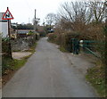
Electricity substation, Cwmfelinfach
Located at the southern end of Twyn Gwyn Road, near the Commercial Road junction.
Image: © Jaggery
Taken: 14 Mar 2012
0.03 miles
2
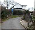
Bends ahead, Twyn Gwyn Road, Cwmfelinfach
A sign warns of bends ahead. On the right is a barrier http://www.geograph.org.uk/photo/2849102 at the edge of a path into woods.
Image: © Jaggery
Taken: 14 Mar 2012
0.03 miles
3
Metal barrier across a path, Cwmfelinfach
The barrier at the edge of Twyn Gwyn Road prevents anything wider than the narrow entrance on the left from accessing a path http://www.geograph.org.uk/photo/2849096 into woods.
Image: © Jaggery
Taken: 14 Mar 2012
0.03 miles
4
Path into woodland, Cwmfelinfach
A path heads away from a barrier on the east side of Twyn Gwyn Road.
Image: © Jaggery
Taken: 14 Mar 2012
0.03 miles
5
Maindee Road (A4048), Cwmfelinfach
The name Cwmfelinfach comes from a small flannel mill that once stood close to the river.
The building at the road junction is Coronation Buildings named after the coronation of King Edward VII in 1902.
There was also a nearby Coronation Colliery http://www.geograph.org.uk/photo/1797090 .
Image: © Robin Drayton
Taken: 7 Apr 2010
0.03 miles
6
Bend in Twyn Gwyn Road, Cwmfelinfach
Walkers can avoid this potentially dangerous section of road (no pavements) by using a short cut.http://www.geograph.org.uk/photo/2849121
Image: © Jaggery
Taken: 14 Mar 2012
0.05 miles
7
Short cut, Twyn Gwyn Road, Cwmfelinfach
Two concrete posts are at the start of a 35-metre short cut giving walkers a safer
alternative to using a sharp bend in the course of narrow, pavementless Twyn Gwyn Road.
The Unsuitable for HGVs sign of course refers to the roadway!
Image: © Jaggery
Taken: 14 Mar 2012
0.05 miles
8
Unsuitable for HGVs, Twyn Gwyn Road, Cwmfelinfach
The road ahead is narrow, steep and bendy. Though there is no letter V in the Welsh alphabet, the Welsh for HGVs shown on the blue sign is the same as in English.
Image: © Jaggery
Taken: 14 Mar 2012
0.05 miles
9
New Road Cwmfelinfach
This shows the view towards the Pioneer Hotel Cwmfelinfach. The pillars and railings to the left mark the front of the Miners Institute, now demolished following a fire. The houses on the right date from around 1912. Near the centre is the direction sign for Ynys Howell, reached down Islwyn Street, named after the Welsh poet buried at Babell Chapel.
Image: © Peter Hutchings
Taken: 15 Jul 2004
0.05 miles
10
Information Board, Cwmfelinfach
Historical information provided as part of the Loops and Links project.
Image: © Robin Drayton
Taken: 7 Apr 2010
0.06 miles


