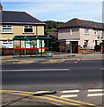
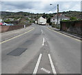
1
East along Springfield Road, Pontymister
Viewed across Mill Street. Ty-Isaf Baptist Church https://www.geograph.org.uk/photo/5758561 is on the right.
Image: © Jaggery
Taken: 1 May 2018
0.03 miles
2
The sun shines on Pontymister
View from Upper Ochrwyth
Image: © Roger Cornfoot
Taken: 1 Mar 2007
0.04 miles
3
Ty-Isaf Baptist Church, Pontymister
On the corner of Springfield Road and Mill Street. The year stone on the left side of the church shows 1922.
Image: © Jaggery
Taken: 1 May 2018
0.05 miles
4
Ty-Isaf Baptist Church, Pontymister
On the corner of Springfield Road and Mill Street.
Image: © Robin Drayton
Taken: 22 Mar 2010
0.06 miles
5
West side of Ty-Isaf Baptist Church, Pontymister
Viewed across Mill Street on May 1st 2018. A banner shows that
a coffee morning is held in the church every Thursday from 10am.
Image: © Jaggery
Taken: 1 May 2018
0.06 miles
6
Bus stop and shelter on a Pontymister corner
Located on the corner of Ty Isaf Crescent, the stop alongside the B4591 is for buses to Newport.
Image: © Jaggery
Taken: 30 Apr 2018
0.07 miles
7
North along Mill Street, Pontymister
Ahead for an entrance to Risca & Pontymister railway station. The Springfield Road junction is on the right.
Image: © Jaggery
Taken: 1 May 2018
0.07 miles
8
Junction of Ty Isaf Crescent and the B4591, Pontymister
The cars are parked in Ty Isaf Crescent.
Image: © Jaggery
Taken: 30 Apr 2018
0.07 miles
9
Mill Street Car Park, Pontymister
Small free car park on the west side of Mill Street.
Image: © Jaggery
Taken: 1 May 2018
0.08 miles
10
Fenced-off building site, Mill Street, Pontymister
Viewed from the corner of the B4591 Newport Road in late November 2018.
Image: © Jaggery
Taken: 22 Nov 2018
0.08 miles


