1
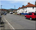
WNW along Ty-Isaf Park Avenue, Pontymister
Looking to the west northwest along Ty-Isaf Park Avenue towards Springfield Road and Ty-Isaf Crescent.
Image: © Jaggery
Taken: 30 Apr 2018
0.04 miles
2
Newport Road houses, Pontymister
Viewed across the B4591 Newport Road in April 2018.
There are no houses on the camera side of the road.
Image: © Jaggery
Taken: 30 Apr 2018
0.04 miles
3
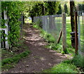
Path past the eastern edge of a cricket field, Pontymister
From Newport Road, the path leads to the north bank of the Ebbw River.
The gap in the fence near a litter bin is an entrance to Pontymister Cricket Club's cricket field. https://www.geograph.org.uk/photo/5968681
Image: © Jaggery
Taken: 30 Apr 2018
0.04 miles
4
Children's play area in Pontymister
On the south side of Newport Road near the corner of Fields Road.
Image: © Jaggery
Taken: 30 Apr 2018
0.04 miles
5
Row of houses, Newport Road, Pontymister
On the north side of the B4591 Newport Road.
Image: © Jaggery
Taken: 30 Apr 2018
0.07 miles
6
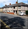
Three-storey flats, Ty Isaf Park Avenue, Pontymister
On the corner of Springfield Road.
Image: © Jaggery
Taken: 30 Apr 2018
0.08 miles
7
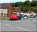
Royal Mail van on a Pontymister corner
Parked on the corner of Ty-Isaf Park Avenue and Ty-Isaf Park Circle while its driver delivers letters and small parcels to nearby houses.
Image: © Jaggery
Taken: 30 Apr 2018
0.08 miles
8
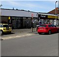
Pricedown Stores, Meadow Crescent, Pontymister
A Premier convenience store viewed in April 2018.
A July 2012 Google Earth Street View shows a Londis convenience store here.
Image: © Jaggery
Taken: 30 Apr 2018
0.08 miles
9
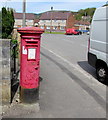
King George VI pillarbox, Meadow Crescent, Pontymister
In need of a repaint in April 2018, the pillarbox is located near Pricedown Stores.
The top of the pillarbox is in the background here https://www.geograph.org.uk/photo/5757321 behind the red phonebox.
King George VI reigned from December 11th 1936 to February 6th 1952.
Image: © Jaggery
Taken: 30 Apr 2018
0.08 miles
10
Former red phonebox, Meadow Crescent, Pontymister
The telephone formerly in the box has been removed by BT.
A Payphone Kiosk Removal notice remains in the box on April 30th 2018.
Image: © Jaggery
Taken: 30 Apr 2018
0.08 miles


