1
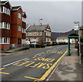
Eastern approach to Church Road railway bridge, Risca
The view west along Church Road towards a blind bend under a railway bridge http://www.geograph.org.uk/photo/2238570 carrying the Ebbw Valley Railway. The steps http://www.geograph.org.uk/photo/2238572 lead up to Sarn Place.
Image: © Jaggery
Taken: 17 Jan 2011
0.01 miles
2
American Villas, Church Road, Risca
Houses set back from, and above, the NE side of Church Road.
Image: © Jaggery
Taken: 17 Jan 2011
0.01 miles
3
Risca viewed from Medart
View from the Cwm Carn Forest Drive.
Image: © Alan Hughes
Taken: 14 Jun 2022
0.01 miles
4
1911 inscription on Longbridge Court, St Mary Street, Risca
Located here, http://www.geograph.org.uk/photo/1759977 the inscription records that building was originally
the Risca branch of Blaina Industrial & Provident Society Ltd.
Image: © Jaggery
Taken: 10 Jan 2017
0.02 miles
5
The Exchange Inn, Risca
At 52 St Mary Street, opposite Exchange Road. Text on the nameboard shows EST(ABLISHED) 1831.
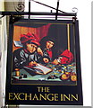
The Whatpub website states that the inn takes its name from the era when horses were exchanged before continuing a coach journey. However, the name sign http://www.geograph.org.uk/photo/5249898 depicts a medieval scene showing another type of exchange.
Image: © Jaggery
Taken: 10 Jan 2017
0.03 miles
6
The Exchange Inn name sign, Risca
Hanging from a wall bracket here. http://www.geograph.org.uk/photo/5249892
Image: © Jaggery
Taken: 10 Jan 2017
0.03 miles
7
Risca Workmans Top Club & Institute
The spelling and punctuation of the club's name is as it appears above the entrance here at 60 St Mary Street.
Image: © Jaggery
Taken: 10 Jan 2017
0.03 miles
8
St Mary the Virgin, Risca
Image: © Roger Cornfoot
Taken: 1 Mar 2007
0.04 miles
9
Top Club bus stop and shelter, Risca
Alongside the B4591 St Mary Street, outside Risca Workmans Top Club & Institute. http://www.geograph.org.uk/photo/5250362
This stop is for buses to Newport, and for the X16 bus to Cardiff.
Image: © Jaggery
Taken: 10 Jan 2017
0.04 miles
10
Exchange Stores and post office, Risca
A post office is inside this Premier convenience store at 55 St Mary Street, on the corner of Exchange Road, opposite the Exchange Inn. http://www.geograph.org.uk/photo/5249892
Image: © Jaggery
Taken: 10 Jan 2017
0.04 miles


