1
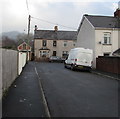
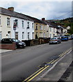
Trafalgar Street, Risca
Towards the Francis Street junction.
Image: © Jaggery
Taken: 20 Dec 2016
0.00 miles
2
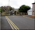
Towards a bend in Trafalgar Street, Risca
The street turns through about 90 degrees ahead, from heading NNW to heading ESE.
Image: © Jaggery
Taken: 20 Dec 2016
0.02 miles
3
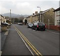
Autocentres, Risca
Garage on the corner of Commercial Street and Trafalgar Street.
Image: © Jaggery
Taken: 20 Dec 2016
0.05 miles
4
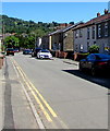
Turning area at the northern end of Llanarth Square, Risca
Viewed in December 2016. Double yellow lines on both sides indicate no parking at any time. Llanarth Square must have had a different configuration when it was named. Now it is a straight dead street.
Image: © Jaggery
Taken: 20 Dec 2016
0.05 miles
5
Llanarth Square, Risca
Dead end street on the north side of Commercial Street.
The reason for this straight street being named a Square is not apparent in 2016.
Image: © Jaggery
Taken: 20 Dec 2016
0.05 miles
6
Llanarth Square, Pontymister
Looking north from near the corner of the B4591 Commercial Street.
Image: © Jaggery
Taken: 22 Jun 2018
0.05 miles
7
Warning sign - School/Ysgol, Mill Street, Pontymister
The English/Welsh sign is on the approach to Ty Isaf Infants & Nursery School.
Image: © Jaggery
Taken: 1 May 2018
0.06 miles
8
Spacious parking area, Risca and Pontymister railway station
Risca and Pontymister station was built during 2007, with the park and ride motorist very much in mind. Parking, viewed here from the west, is available alongside the station. There are 88 spaces plus 6 for disabled badge holders.
Image: © Jaggery
Taken: 11 Mar 2010
0.06 miles
9
Ty Isaf Infants School, Risca
Viewed across Mill Street. A colourful mural and colourful entrance gates (red, blue, yellow and green) greet the visitor. The infants' school also has a nursery, giving an age range of 3 to 11 for the c180 children enrolled here.
Image: © Jaggery
Taken: 17 Feb 2011
0.06 miles
10
The Myrtle Grove, Pontymister
Image: © John Lord
Taken: 10 Feb 2009
0.06 miles


