1
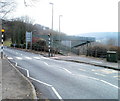
Chapel Street, Abercarn
The view to the south along Chapel Street, a cul-de-sac connecting with Hill Street (ahead).
Image: © Jaggery
Taken: 24 Jan 2011
0.02 miles
2
Field bordering Chapel Street, Abercarn
Viewed from a path http://www.geograph.org.uk/photo/2286549
The field is between Abercarn cemetery http://www.geograph.org.uk/photo/2286446 and Chapel Street.
Image: © Jaggery
Taken: 24 Jan 2011
0.02 miles
3
Corner of Brook Street and High Meadow, Abercarn
Viewed from near the B4591. The house behind the red car is 1, Brook Street.
Image: © Jaggery
Taken: 23 Jan 2011
0.05 miles
4
Closeup view of a disused George V postbox, Abercarn
The disused postbox is in a wall http://www.geograph.org.uk/photo/2286842 between Hill Street and the B4591. Originally showing OUT OF SERVICE, the metal strip covering the mouth of the box is itself nearly out of service, presumably after some attention from vandals. It may not be long before the ivy partly covering the wall grows over this sorry specimen.
Image: © Jaggery
Taken: 24 Jan 2011
0.05 miles
5
Out-of-service George V postbox, Abercarn
A battered postbox in a wall between Hill Street and the B4591 has been replaced by a postbox mounted on a stand nearby. The metal strip across the mouth of box is itself in a battered condition. http://www.geograph.org.uk/photo/2286864
Image: © Jaggery
Taken: 24 Jan 2011
0.05 miles
6
Channelled brook, Brook Street, Abercarn
A brook flows down a channel on the east side of Brook Street.
Image: © Jaggery
Taken: 23 Jan 2011
0.05 miles
7
Turning area at the far end of Chapel Street, Abercarn
The turning area is at the edge of woods named Craig Glan-sion.
Image: © Jaggery
Taken: 24 Jan 2011
0.05 miles
8
Storage facilities, Brook Street, Abercarn
Behind a lock-up shed is a long-abandoned road trailer, with half of its side missing.
Image: © Jaggery
Taken: 23 Jan 2011
0.05 miles
9
Top end of Hill Street, Abercarn
A path http://www.geograph.org.uk/photo/2286549 from Abercarn cemetery reaches houses at the top (east) end of Hill Street.
Image: © Jaggery
Taken: 24 Jan 2011
0.07 miles
10
A467 footbridge, Abercarn
Viewed across the B4591. The A467 runs (at a slightly lower level) parallel with the B4591 for much of their course through Abercarn.
Image: © Jaggery
Taken: 23 Jan 2011
0.09 miles


