1
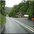
Ebbw Valley Walk, Load of Hay Lane
Path going to Trinant from Lane. The enclosure on the right appears to be for livestock in transit, and possibly small vehicles.
Image: © M J Roscoe
Taken: 23 Oct 2015
0.06 miles
2
Hillside footpath above old mine, Crumlin
A field footpath from the Ebbw Valley Walk going north along the hillside above the A467. The area is part of the Llanerch-Isaf Woodland site of Importance for Nature Conservation.
Image: © M J Roscoe
Taken: 27 Dec 2016
0.07 miles
3
Load of Hay Lane, above Crumlin
The start of the narrower section of the Lane down to Crumlin
Image: © M J Roscoe
Taken: 23 Oct 2015
0.08 miles
4
Southern edge of former Navigation Colliery, Crumlin
Navigation Colliery closed in 1967. The colliery site ahead, an outstanding example of industrial architecture, has a total of 5 Grade II* and 8 Grade II listed structures or buildings.
Image: © Jaggery
Taken: 17 Feb 2011
0.08 miles
5
Grade II* listed former Navigation Colliery chimney, Crumlin
Located between the former north and south winding engine houses, the chimney was Grade II* listed in January 1982, one of thirteen examples of listed structures in this site of outstanding industrial architecture.
Image: © Jaggery
Taken: 17 Feb 2011
0.08 miles
6
Crumlin : Grade II* listed former Navigation Colliery chimney viewed from the north
Located between the former north and south winding engine houses, the chimney was Grade II* listed in January 1982, one of thirteen examples of listed structures in this site of outstanding industrial architecture.
Image: © Jaggery
Taken: 17 Feb 2011
0.08 miles
7
Kendon Road, Crumlin
Image: © Ian S
Taken: 24 May 2014
0.10 miles
8
Former Navigation Colliery buildings, Crumlin
There are 5 Grade II* and 8 Grade II listed structures in this site of outstanding industrial architecture. Navigation Colliery closed in 1967.
Image: © Jaggery
Taken: 17 Feb 2011
0.10 miles
9
Central part of former Navigation Colliery buildings, Crumlin
Navigation Colliery closed in 1967. There are thirteen listed structures in this site of outstanding industrial architecture.
Image: © Jaggery
Taken: 17 Feb 2011
0.10 miles
10
Buildings, former Navigation Colliery, Crumlin
Viewed from the A467. There are thirteen listed structures in this site of outstanding industrial architecture.
Image: © Jaggery
Taken: 17 Feb 2011
0.10 miles


