1
The Rhiwderin Inn, Rhiwderin
Image: © Ruth Sharville
Taken: 7 Sep 2010
0.00 miles
2
Rhiwderin Inn, Rhiwderin
The A468 Caerphilly Road side of the Rhiwderin Inn on the corner of Pentre-Tai Road.
In April 2019 a Rhiwderin Inn information board shows Real Food - Real Ale - Real Pub.
Image: © Jaggery
Taken: 17 Apr 2019
0.01 miles
3
Level crossing, Rhiwderin
Image: © John Lord
Taken: 12 Jan 2012
0.01 miles
4
Class 37 locomotive at Rhiwderin Crossing
Colas Rail class 37 No. 37219 is seen on track data recording duties (with extra, technical equipment mounted on its ends) at Rhiwderin Crossing on its way to Machen Quarry.
Image: © Gareth James
Taken: 15 Jul 2018
0.01 miles
5
Rhiwderin Level Crossing notices
On the right here. https://www.geograph.org.uk/photo/6128543 The text on the red notice is in Welsh and English.
Image: © Jaggery
Taken: 17 Apr 2019
0.01 miles
6
East side of the Rhiwderin Inn, Rhiwderin
Viewed across the pub's car park from near the pub information board https://www.geograph.org.uk/photo/6122996 alongside Caerphilly Road.
Image: © Jaggery
Taken: 17 Apr 2019
0.01 miles
7
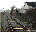
Single-track railway from Rhiwderin towards Bassaleg Junction
In 2019 the former passenger route connects Machen quarry with Bassaleg Junction.
Viewed from this level crossing. https://www.geograph.org.uk/photo/6128543
Image: © Jaggery
Taken: 17 Apr 2019
0.01 miles
8
The Rhiwderin Inn, Rhiwderin
Image: © John Lord
Taken: 12 Jan 2012
0.01 miles
9
Rhiwderin Level Crossing
The intersection of Pentre Tai Road and a single-track railway near the former Rhiwderin station, now a private residence. The station closed in March 1954. The railway remains in use in 2019 to connect Machen quarry with Park Junction, Newport. The quarry provides ballast for the western region of Network Rail.
Image: © Jaggery
Taken: 17 Apr 2019
0.02 miles
10
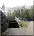
Steps up to Caerphilly Road, Rhiwderin
Behind the bridge here. https://www.geograph.org.uk/photo/6128558
Image: © Jaggery
Taken: 17 Apr 2019
0.02 miles


