1
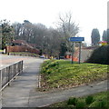
South side of Parkwood Drive, Newport
Houses on the south side of Parkwood Drive, Pentrepoeth, Bassaleg, viewed from the corner of Cwm Cwddy Drive.
Image: © Jaggery
Taken: 29 May 2010
0.03 miles
2
Parkwood Drive, Newport
The western end of Parkwood Drive, Pentrepoeth, Bassaleg, viewed from Cwm Cwddy Drive.
Image: © Jaggery
Taken: 29 May 2010
0.09 miles
3
Llwyn Deri Close, Newport
Viewed from Cwm Cwddy Drive, Pentrepoeth, Bassaleg.
Image: © Jaggery
Taken: 29 May 2010
0.10 miles
4
Caerphilly Close, Rhiwderin
Viewed from the Caerphilly Road (A468) end. The Friendly Fox pub is on the right. http://www.geograph.org.uk/photo/1780840
Image: © Jaggery
Taken: 5 Mar 2011
0.14 miles
5
NW boundary of Bassaleg
Viewed from Rhiwderin, near the Friendly Fox pub. http://www.geograph.org.uk/photo/1780840
The road on the left is Caerphilly Road (A468).
Image: © Jaggery
Taken: 5 Mar 2011
0.17 miles
6
Caerphilly Road bus shelter, Rhiwderin
The bus stop, near the Laurel Road junction, http://www.geograph.org.uk/photo/2771362 is mainly used by Stagecoach buses on route 50 from Newport to Bargoed via Caerphilly.
Image: © Jaggery
Taken: 5 Mar 2011
0.20 miles
7
The Friendly Fox pub sign, Rhiwderin
Located in a frame at the roadside edge of the pub. http://www.geograph.org.uk/photo/1780840
Adult foxes are usually about 2 feet long, so either the one depicted here is a very large fox, or the woman is very short!
Image: © Jaggery
Taken: 5 Mar 2011
0.20 miles
8
Corner of Laurel Road and Caerphilly Road, Rhiwderin
The houses are at the western end of Laurel Road, viewed across Caerphilly Road (A468).
Image: © Jaggery
Taken: 5 Mar 2011
0.20 miles
9
Eastern boundary of Rhiwderin
Caerphilly Road (A468) on the right leaves Bassaleg and enters Rhiwderin. The Rhiwderin boundary is marked by a small white-on-blue sign. The building in the background is The Friendly Fox pub. http://www.geograph.org.uk/photo/1780840
Caerphilly Close is on the left.
Image: © Jaggery
Taken: 5 Mar 2011
0.20 miles
10
Friendly Fox, Rhiwderin
Pub on Caerphilly Road in Rhiwderin, near the Bassaleg boundary.
Regular features include quiz night on Sundays and Curry Club on Monday nights.
Image: © Jaggery
Taken: 1 Apr 2010
0.20 miles


