1
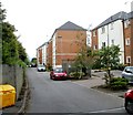
View towards the north-west, Gaer Fort, Newport.
Looking over houses at Pye Corner.
Image: © Robin Drayton
Taken: 28 Aug 2021
0.11 miles
2
Golden Mile View flats, Newport
The flats, on the SW side of Bassaleg Road, are contained in several individually-named buildings. Beyond the hedge and fence on the left are railway lines formerly part of the Golden Mile. http://www.geograph.org.uk/photo/2528638
Image: © Jaggery
Taken: 21 Jul 2011
0.14 miles
3
Inscription on old footbridge, Tredegar Park
The inscription reads :
MR R RAINE
SURVEYOR
TO THE RIGHT HONBLE
THE LORD TREDEGAR
1870
This was Charles Morgan Robinson Morgan who became Baron Tredegar in 1859 and died 1875.
It appears that a crest has been removed from the top of the metal plate.
Image: © Robin Drayton
Taken: 22 Feb 2021
0.16 miles
4
Old footbridge over the River Ebbw
The Coflein (Royal Commission on the Ancient and Historical Monuments of Wales) website states
“Tredegar Park Tramroad connects Tredegar Park Forge with Sir Charles Morgan's Park Mile Railway.
The tramroad crosses River Ebbw on stone-piered bridge, with a later (1870) cast iron span.”
It is situated in what was Lord Tredegar’s Deer Park.
In the 20th century it gave access from the Tredegar Park Golf Course clubhouse to the fairways.
Image: © Robin Drayton
Taken: 22 Feb 2021
0.16 miles
5
Bridge across the River Ebbw
An old footbridge across the River Ebbw. The bridge, shown as a footbridge on current OS maps, is presently closed, and lies in the grounds of the former Tredegar House deer park.
Image: © Gareth James
Taken: 31 Oct 2016
0.16 miles
6
Bridge across the River Ebbw
An old footbridge across the River Ebbw. The bridge, shown as a footbridge on current OS maps, is presently closed. One of the pillars appears to have a distinct list, which may (or may not) be the cause of the closure. The bridge lies within the grounds of the former Tredegar House deer park.
Image: © Gareth James
Taken: 31 Oct 2016
0.16 miles
7
Bridge across the River Ebbw
An old footbridge across the River Ebbw. The bridge, shown as a footbridge on current OS maps, is presently closed, and lies in the grounds of the former Tredegar House deer park. At least one source states this bridge to have once carried a tramroad.
Image: © Gareth James
Taken: 31 Oct 2016
0.16 miles
8
Bridge across the River Ebbw
An old footbridge across the River Ebbw. The bridge, shown as a footbridge on current OS maps, is presently closed, and lies in the grounds of the former Tredegar House deer park. At least one source states this bridge to have once carried a tramroad.
Image: © Gareth James
Taken: 31 Oct 2016
0.16 miles
9
Corner of Golden Mile View and Bassaleg Road, Newport
Viewed across Bassaleg Road. There are about 120 flats in Golden Mile View, contained in several individually-named buildings, most of which are out of shot. The one on the left is Griffin House.
Golden Mile View is at the edge of a section of railway line that passed through Lord Tredegar's estate. He charged a levy of one penny per mile per ton of coal crossing his land. That may not sound like much, but for a while (1870s) Newport Docks was the largest exporter of coal in the world, and it all passed along the Golden Mile.
Image: © Jaggery
Taken: 21 Jul 2011
0.18 miles
10
Bassaleg Road houses near the M4 motorway, Newport
On each side of the M4 motorway, several Bassaleg Road houses, as here, are alongside a section of roadway separate from the current course of Bassaleg Road.
Bassaleg Road was realigned slightly when the motorway was built beneath it in the 1960s. On this side of the road, one house, 160 Bassaleg Road, had to be demolished to make way for the M4.
Image: © Jaggery
Taken: 21 Jul 2011
0.18 miles


