1
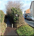
Paxton Walk, Rogerstone, Newport
Viewed across Ruskin Avenue.
Image: © Jaggery
Taken: 23 Jan 2014
0.04 miles
2
Sward Close, Rogerstone, Newport
A short cul-de-sac on the west side of Ruskin Avenue.
Image: © Jaggery
Taken: 23 Jan 2014
0.04 miles
3
North side of Sward Close, Rogerstone, Newport
Viewed from the corner of Ruskin Avenue.
Image: © Jaggery
Taken: 23 Jan 2014
0.04 miles
4
No cars or motorbikes ahead, Groes Road, Rogerstone, Newport
It seems that this narrow path, shown as Groes Road on some maps, is a right of way existing from before the modern houses surrounding it were built. The sign shows no cars or motorbikes, but the function of the concrete posts is unclear. The gap is wide enough for a motorbike to pass through.
The way ahead looks to be too narrow for a car. Paxton Walk is on the right. http://www.geograph.org.uk/photo/3823868
Image: © Jaggery
Taken: 23 Jan 2014
0.04 miles
5
Johnston Close, Rogerstone, Newport
Viewed from Ruskin Avenue looking along Johnston Close towards Scott Walk.
Image: © Jaggery
Taken: 23 Jan 2014
0.05 miles
6
Ruskin Avenue passes Delius Close, Rogerstone, Newport
Delius Close http://www.geograph.org.uk/photo/3823899 is on the left. Paxton Walk http://www.geograph.org.uk/photo/3823868 is ahead on the right.
Image: © Jaggery
Taken: 23 Jan 2014
0.05 miles
7
Footpath formerly a country road, Rogerstone, Newport
In 2014, vehicular access along Groes Road ends a couple of metres behind the camera at this http://www.geograph.org.uk/photo/3943930 junction. Old maps show that Groes Road used to extend to the B4591 Cefn Road along the route ahead, now blocked off to make it a footpath.
Image: © Jaggery
Taken: 23 Jan 2014
0.06 miles
8
Bentley Close, Rogerstone, Newport
Viewed across Ruskin Avenue.
Image: © Jaggery
Taken: 23 Jan 2014
0.07 miles
9
King George V postbox, Ruskin Avenue, Rogerstone, Newport
Located near the corner of Sward Close. A postbox sometimes indicates when the adjacent houses were built, but this is not true here. King George V reigned from May 1910-January 1936. A 1940s map shows that this area was farmland. There was a road nearby at that time, Groes Road, so it seems likely that the postbox was installed for a farming community.
Image: © Jaggery
Taken: 23 Jan 2014
0.07 miles
10
Holland Close, Rogerstone, Newport
Houses on the north side of Holland Close, viewed from Ruskin Avenue.
Image: © Jaggery
Taken: 23 Jan 2014
0.07 miles


