IMAGES TAKEN NEAR TO
High Street, WELLINGBOROUGH, NN8 4HR
Introduction
This page details the photographs taken nearby to High Street, NN8 4HR by members of the Geograph project.
The Geograph project started in 2005 with the aim of publishing, organising and preserving representative images for every square kilometre of Great Britain, Ireland and the Isle of Man.

There are currently over 7.5m images from over14,400 individuals and you can help contribute to the project by visiting https://www.geograph.org.uk
Image Map (Loading...)


Getting Data...Please wait
Leaflet Map data © OpenStreetMap
Images are licensed for reuse under creativecommons.org/licenses/by-sa/2.0
Notes
- Clicking on the map will re-center to the selected point.
- The higher the marker number, the further away the image location is from the centre of the postcode.
Image Listing (89 Images Found)
Images are licensed for reuse under creativecommons.org/licenses/by-sa/2.0
Image
Details
Distance
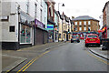
1
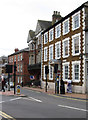
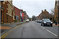
Wellingborough - offices on High Street
Opposite the junction with Church Street.
Image: © Dave Bevis
Taken: 9 Jun 2012
0.01 miles
2
Wellingborough - west end of Church Street
Image: © Dave Bevis
Taken: 9 Jun 2012
0.02 miles
3
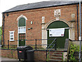
Wellingborough - New Life Tabernacle Church
Image: © Dave Bevis
Taken: 9 Jun 2012
0.03 miles
4
Wellingborough - Saint Heliers
On High Street.
Image: © Dave Bevis
Taken: 9 Jun 2012
0.04 miles
5
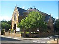
Wellingborough: United Reformed Church
The United Reformed Church is on the High Street. It was originally constructed as the Congregational Church around 1875 to the designs of the architect E Sharman to a plan by Caleb Archer, and built by J Boddington & Co. The roof, which appears to be circular from the front of the building, is actually an irregular flattened ellipse in plan. It is a Grade II* Listed Building.
Image: © Nigel Cox
Taken: 14 Jun 2019
0.06 miles
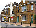
6
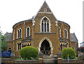
Wellingborough - United Reformed Church
Showing High Street frontage.
Image: © Dave Bevis
Taken: 9 Jun 2012
0.06 miles
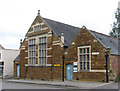
7
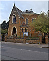
Wellingborough United Reformed Church
Wellingborough United Reformed Church is on the corner of High Street and Queen Street. It was originally constructed around 1875 as a Congregational Church. It is a Grade II* Listed Building (Historic England List Entry Number: 1191513 https://historicengland.org.uk/listing/the-list/list-entry/1191513 ).
Image: © David Dixon
Taken: 21 Oct 2019
0.06 miles
10
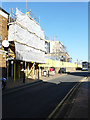
Tresham Institute of Further & Higher Education, Church Street
Planning permission has been granted, with conditions, by Wellingborough Borough Council under application number WP/2013/0605 for the “development of a 3 storey building for educational use with associated infrastructure and landscaping to include demolition of existing”.
Image: © John Baker
Taken: 15 Feb 2019
0.06 miles