Wellingborough United Reformed Church
Introduction
The photograph on this page of Wellingborough United Reformed Church by David Dixon as part of the Geograph project.
The Geograph project started in 2005 with the aim of publishing, organising and preserving representative images for every square kilometre of Great Britain, Ireland and the Isle of Man.

There are currently over 7.5m images from over 14,400 individuals and you can help contribute to the project by visiting https://www.geograph.org.uk
Wellingborough United Reformed Church
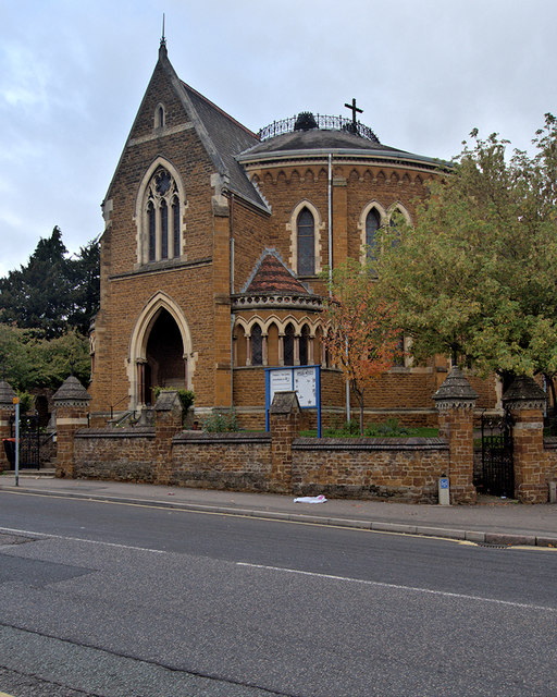
Image: © David Dixon Taken: 21 Oct 2019
Wellingborough United Reformed Church is on the corner of High Street and Queen Street. It was originally constructed around 1875 as a Congregational Church. It is a Grade II* Listed Building (Historic England List Entry Number: 1191513 https://historicengland.org.uk/listing/the-list/list-entry/1191513 ).
Images are licensed for reuse under creativecommons.org/licenses/by-sa/2.0
Image Location
Latitude
52.302836
Longitude
-0.696772