
IMAGES TAKEN NEAR TO
Bell Court, WELLINGBOROUGH, NN8 4DZ
Introduction
This page details the photographs taken nearby to Bell Court, NN8 4DZ by members of the Geograph project.
The Geograph project started in 2005 with the aim of publishing, organising and preserving representative images for every square kilometre of Great Britain, Ireland and the Isle of Man.

There are currently over 7.5m images from over14,400 individuals and you can help contribute to the project by visiting https://www.geograph.org.uk
Image Map
Images are licensed for reuse under creativecommons.org/licenses/by-sa/2.0
Notes
- Clicking on the map will re-center to the selected point.
- The higher the marker number, the further away the image location is from the centre of the postcode.
Image Listing (16 Images Found)
Images are licensed for reuse under creativecommons.org/licenses/by-sa/2.0
Image
Details
Distance
1
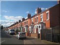
Wellingborough: Thomas Street
This neat row of terraced houses probably dates from the 1890s. It is not present on the large scale Ordnance Survey map of 1888, but is present (the houses on this side of the street, not those on the other) on that of 1900.
Image: © Nigel Cox
Taken: 14 Jun 2019
0.14 miles
3
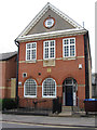
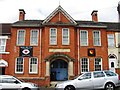
Wellingborough - Masonic Hall
On Mill Road.
Image: © Dave Bevis
Taken: 9 Jun 2012
0.17 miles
4
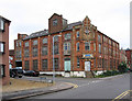
Wellingborough - Gilmour & Vale engineering works
On Mill Road.
Image: © Dave Bevis
Taken: 9 Jun 2012
0.17 miles
5
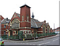
Wellingborough - Baptist Church
On Mill Road.
Image: © Dave Bevis
Taken: 9 Jun 2012
0.17 miles
6
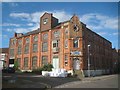
Wellingborough: Former boot and shoe factory
This area of Wellingborough is littered with scattered odd buildings that reflect the town's industrial past. This former boot and shoe factory, at the junction of Strode Road with Mill Road, dates from 1898. It was latterly occupied by the engineering firm of Gilmour & Vale, and now appears to be disused, although the pile of building material bags outside would suggest that refurbishment work is imminent.
Please see Dave Bevis's photograph of the same building from the same viewpoint in 2012 here Image]
Image: © Nigel Cox
Taken: 14 Jun 2019
0.17 miles
7
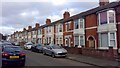
Albert Road
Victorian terraces in Wellingborough.
Image: © Burgess Von Thunen
Taken: 14 Jan 2019
0.18 miles
8
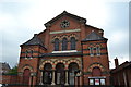
Great Park Street Methodist Church, Wellingborough
This is the largest Methodist Church building in Wellingborough, built in 1872. The building was extended to the rear to provide school rooms and to the right to create a hall in 1914.
Image: © Helen
Taken: 21 Jul 2014
0.18 miles
9
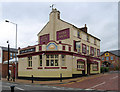
Wellingborough - The Rising Sun
On Mill Road.
Image: © Dave Bevis
Taken: 9 Jun 2012
0.18 miles
10
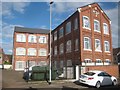
Wellingborough: Former boot and shoe factory
This area of Wellingborough is littered with scattered odd buildings that reflect the town's industrial past. This former boot and shoe factory, at the junction of Thomas Street with Mill Road, probably dates from the 1890s. It was latterly a warehouse, but now appears to be in residential use.
Image: © Nigel Cox
Taken: 14 Jun 2019
0.19 miles