
IMAGES TAKEN NEAR TO
Fallowfields, NORTHAMPTON, NN6 7GA
Introduction
This page details the photographs taken nearby to Fallowfields, NN6 7GA by members of the Geograph project.
The Geograph project started in 2005 with the aim of publishing, organising and preserving representative images for every square kilometre of Great Britain, Ireland and the Isle of Man.

There are currently over 7.5m images from over14,400 individuals and you can help contribute to the project by visiting https://www.geograph.org.uk
Image Map
Images are licensed for reuse under creativecommons.org/licenses/by-sa/2.0
Notes
- Clicking on the map will re-center to the selected point.
- The higher the marker number, the further away the image location is from the centre of the postcode.
Image Listing (112 Images Found)
Images are licensed for reuse under creativecommons.org/licenses/by-sa/2.0
Image
Details
Distance
1
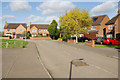
Bury Dyke, Crick
Modern detached houses at the eastern end of Crick village, close to the primary school. It is worth noting that Crick's population increased by more than 25% between 2001 and 2011.
Image: © Stephen McKay
Taken: 17 Oct 2017
0.11 miles
2
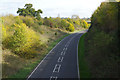
Crick By-Pass
The A428 has by-passed Crick village since the 1990s. This view might give the impression it is not well used.
Image: © Stephen McKay
Taken: 17 Oct 2017
0.12 miles
3

The Royal Oak Pub, Crick
Church Street, Crick, Northampton, NN6 7TP close to the Grand Union Canal Leicester Section
Image: © canalandriversidepubs co uk
Taken: Unknown
0.14 miles
4

Crick-The Royal Oak
On Church Street. One of three public houses in the village.
Image: © Ian Rob
Taken: 16 May 2009
0.15 miles
5

Crick-Oak Lane
The corner of Oak Lane and Yelvertoft Road.
Image: © Ian Rob
Taken: 16 May 2009
0.15 miles
6

Church Street, Crick
This is where Church Street turns into Yelvertoft Road with Oak Lane leading off to the right. The Royal Oak is one of three pubs in the village.
Image: © Stephen McKay
Taken: 17 Oct 2017
0.15 miles
8

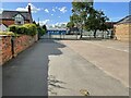
Yelvertoft Road bridge over the A428
Near Crick.
Image: © JThomas
Taken: 29 Mar 2014
0.17 miles
9
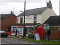
Crick
At the eastern edge of Village on road to West Haddon.
Image: © Ian Rob
Taken: 1 Oct 2005
0.17 miles
10
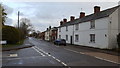
Houses in Crick
Houses on the road leaving Crick to the east.
Image: © Peter Mackenzie
Taken: 26 Nov 2019
0.18 miles