IMAGES TAKEN NEAR TO
Dallington Fields Business Park, Kingsfield Way, NORTHAMPTON, NN5 7QD
Introduction
This page details the photographs taken nearby to Dallington Fields Business Park, Kingsfield Way, NN5 7QD by members of the Geograph project.
The Geograph project started in 2005 with the aim of publishing, organising and preserving representative images for every square kilometre of Great Britain, Ireland and the Isle of Man.

There are currently over 7.5m images from over14,400 individuals and you can help contribute to the project by visiting https://www.geograph.org.uk
Image Map (Loading...)


Getting Data...Please wait
Leaflet Map data © OpenStreetMap
Images are licensed for reuse under creativecommons.org/licenses/by-sa/2.0
Notes
- Clicking on the map will re-center to the selected point.
- The higher the marker number, the further away the image location is from the centre of the postcode.
Image Listing (10 Images Found)
Images are licensed for reuse under creativecommons.org/licenses/by-sa/2.0
Image
Details
Distance
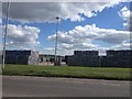
1
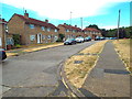
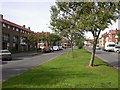
Park Drive, King's Heath, Northampton
Park Drive is one of the main routes for traffic into and out of the King's Heath estate, on the outskirts of Northampton.
Image: © Malc McDonald
Taken: 28 Jul 2018
0.12 miles
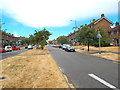
2
Waveney Way, Northampton
Waveney Way is a residential road on the outskirts of Northampton.
This road forms part of National Cycle Network route 6, as it makes its way through Northampton using quiet roads.
Image: © Malc McDonald
Taken: 28 Jul 2018
0.14 miles
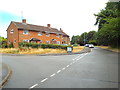
3
St. Margaret's Gardens, Northampton
St Margaret's Gardens is a residential cul-de-sac in Northampton.
Image: © Malc McDonald
Taken: 28 Jul 2018
0.18 miles
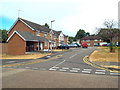
4
Glebeland Road, Northampton
Glebeland Road in the northern suburbs of Northampton.
This road forms part of National Cycle Network route 6, as it threads its way through Northampton using quiet roads.
Image: © Malc McDonald
Taken: 28 Jul 2018
0.18 miles
5
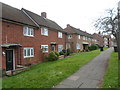
Derwent Drive
1950s council houses in Kings Heath.
Image: © Burgess Von Thunen
Taken: 14 Nov 2014
0.22 miles
6
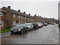
Welland Way, King's Heath, Northampton
Welland Way is a residential road on the King's Heath estate, on the outskirts of Northampton.
Image: © Malc McDonald
Taken: 28 Jul 2018
0.22 miles
7
South Oval
1950s council houses in Kings Heath.
Image: © Burgess Von Thunen
Taken: 6 Nov 2014
0.23 miles
8
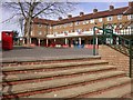
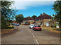
Park Square, King's Heath
The main shopping centre.
Image: © Kokai
Taken: 12 Oct 2006
0.24 miles
9
Park Drive, King's Heath
Taken from near the roundabout on Mill Lane and Park Drive.
Image: © Kokai
Taken: 12 Oct 2006
0.24 miles