1
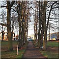
Gospel Hall on Spencer Bridge Road
Image: © Philip Jeffrey
Taken: 9 Jan 2022
0.05 miles
2
Steene Street
Victorian bay-fronted terraces in St James, at the edge of Victoria Park.
Image: © Burgess Von Thunen
Taken: 23 Aug 2011
0.05 miles
3
St. James' Park Road, Northampton
A corner shop at the end of a housing terrace in St. James' Park Road, in Northampton.
St. James' Park Road is on the route of National Cycle Network route 6, as it passes through Northampton using quiet streets.
Image: © Malc McDonald
Taken: 28 Jul 2018
0.08 miles
4
Victoria Park
Decorative stone features.
Image: © Burgess Von Thunen
Taken: 23 Aug 2011
0.11 miles
5
Victoria Park, St James' End, Northampton
This series of large stone pieces, set into an area of rubberised matting, were provided many years ago as a climbing facility for youngsters in the playground area of Victoria Park. The park is situated within a mile of the town centre in the St James district of Northampton and provides a quiet retreat from the busy roads around it. Half of the park was gifted to the town by the Earl Spencer in 1898, making it the second oldest designated park in Northampton and later another 8 acres were purchased from the Earl in 1910/11, making a green space of 16 acres. Ahead are houses lining Spencer Bridge Road (part of the A428) The St James’ area, or more formally: St James' End (but known locally as Jimmy’s End) has been administered as part of the city since 1900. St James' End is now in the Borough Council’s St James Ward.
Image: © David Hallam-Jones
Taken: 27 Dec 2016
0.11 miles
6
Victoria Park, St James' End, Northampton
Victoria Park is situated within a mile of the town centre in the St James district of Northampton and provides a quiet retreat from the busy roads around it. Half of the park was gifted to the town by the Earl Spencer in 1898, making it the second oldest designated park in Northampton and later another 8 acres were purchased from the Earl in 1910/11, making a green space of 16 acres. Ahead are houses lining Spencer Bridge Road (part of the A428) The St James’ area, or more formally: St James' End (but known locally as Jimmy’s End) has been administered as part of the city since 1900. St James' End is now in the Borough Council’s St James Ward.
Image: © David Hallam-Jones
Taken: 27 Dec 2016
0.12 miles
7
St James Park Road
Image: © Oast House Archive
Taken: 1 Jul 2011
0.15 miles
8
Stanley Road
Victorian terraces and 1950s council flats.
Image: © Burgess Von Thunen
Taken: 7 Jan 2015
0.16 miles
9
St. James End, Northampton and The Foundrymans Arms
I once did some work in the 1970's for a foundry based in this part of town. The Crown Foundry made, among other things, piano frames, including for the Dutch and French (Rameau pianos?) markets.
Image: © Chris
Taken: 2 Jul 2014
0.16 miles
10
Victoria Park
Looking towards St James Park Road. The park was gifted by and bought from Earl Spencer between 1898 and 1911. The park was renovated in 2007.
Image: © Burgess Von Thunen
Taken: 23 Aug 2011
0.16 miles


