Victoria Park, St James' End, Northampton
Introduction
The photograph on this page of Victoria Park, St James' End, Northampton by David Hallam-Jones as part of the Geograph project.
The Geograph project started in 2005 with the aim of publishing, organising and preserving representative images for every square kilometre of Great Britain, Ireland and the Isle of Man.

There are currently over 7.5m images from over 14,400 individuals and you can help contribute to the project by visiting https://www.geograph.org.uk
Victoria Park, St James' End, Northampton
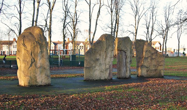
Image: © David Hallam-Jones Taken: 27 Dec 2016
This series of large stone pieces, set into an area of rubberised matting, were provided many years ago as a climbing facility for youngsters in the playground area of Victoria Park. The park is situated within a mile of the town centre in the St James district of Northampton and provides a quiet retreat from the busy roads around it. Half of the park was gifted to the town by the Earl Spencer in 1898, making it the second oldest designated park in Northampton and later another 8 acres were purchased from the Earl in 1910/11, making a green space of 16 acres. Ahead are houses lining Spencer Bridge Road (part of the A428) The St James’ area, or more formally: St James' End (but known locally as Jimmy’s End) has been administered as part of the city since 1900. St James' End is now in the Borough Council’s St James Ward.
Images are licensed for reuse under creativecommons.org/licenses/by-sa/2.0
Image Location
Latitude
52.241521
Longitude
-0.909908