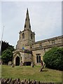
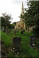
IMAGES TAKEN NEAR TO
High Street, WELLINGBOROUGH, NN29 7HS
Introduction
This page details the photographs taken nearby to High Street, NN29 7HS by members of the Geograph project.
The Geograph project started in 2005 with the aim of publishing, organising and preserving representative images for every square kilometre of Great Britain, Ireland and the Isle of Man.

There are currently over 7.5m images from over14,400 individuals and you can help contribute to the project by visiting https://www.geograph.org.uk
Image Map
Images are licensed for reuse under creativecommons.org/licenses/by-sa/2.0
Notes
- Clicking on the map will re-center to the selected point.
- The higher the marker number, the further away the image location is from the centre of the postcode.
Image Listing (18 Images Found)
Images are licensed for reuse under creativecommons.org/licenses/by-sa/2.0
Image
Details
Distance
1
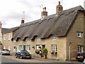
Thatched cottages in Podington
Next to the church, and opposite the garden centre.
Image: © David Hawgood
Taken: 16 Aug 2007
0.01 miles
2
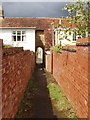
Footpath through archway between stone houses, Podington
The fine street facade of the houses is shown in Image The houses are 18th century, and both have flat-roofed modern extensions at the back, probably including bathrooms.
Image: © David Hawgood
Taken: 16 Aug 2007
0.02 miles
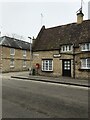
4
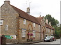
18th century stone houses in Podington
The entry to Podington garden centre is on the left. A public footpath goes into the archway under the gable - a very grand entrance to the path.
Image: © David Hawgood
Taken: 16 Aug 2007
0.02 miles
5
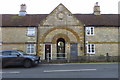
Public footpath through the cottages to Hinwick Lodge Farm
Image: © Philip Jeffrey
Taken: 19 May 2019
0.02 miles
7
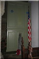
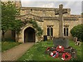
American war memorial in Poddington Church
Image: © Philip Jeffrey
Taken: 19 May 2019
0.04 miles
8
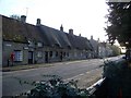
Podington Post Office & High Street
Although Podington is probably better known by its association with the Santa Pod drag racing circuit, the village itself is a jewel of vernacular architecture. It has been described as "an aged village of stone and thatch built around the 13th-Century Church of St Mary the Virgin" from where this photo was taken looking south and west.
Image: © Nigel Stickells
Taken: 9 Nov 2006
0.04 miles