IMAGES TAKEN NEAR TO
Greenland Walk, CORBY, NN18 9DH
Introduction
This page details the photographs taken nearby to Greenland Walk, NN18 9DH by members of the Geograph project.
The Geograph project started in 2005 with the aim of publishing, organising and preserving representative images for every square kilometre of Great Britain, Ireland and the Isle of Man.

There are currently over 7.5m images from over14,400 individuals and you can help contribute to the project by visiting https://www.geograph.org.uk
Image Map (Loading...)


Getting Data...Please wait
Leaflet Map data © OpenStreetMap
Images are licensed for reuse under creativecommons.org/licenses/by-sa/2.0
Notes
- Clicking on the map will re-center to the selected point.
- The higher the marker number, the further away the image location is from the centre of the postcode.
Image Listing (20 Images Found)
Images are licensed for reuse under creativecommons.org/licenses/by-sa/2.0
Image
Details
Distance
1
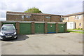
Garage block in Malmo Close
There is an OS benchmark Image on the front of the block at its right hand corner
Image: © phil Richards
Taken: 12 Sep 2019
0.06 miles
2
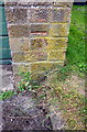
Benchmark on Malmo Close garage block
Ordnance Survey cut mark benchmark described on the Bench Mark Database at www.bench-marks.org.uk/bm111632
Image: © phil Richards
Taken: 12 Sep 2019
0.06 miles
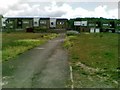
3
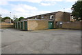
Garage block on east side of Tromso Close
Ordnance Survey records indicate that in 1983 there was a benchmark levelled at 115.381m above Newlyn Datum on the side of the block at the front corner. This part of the side wall appears to have been rebuilt with loss of the mark
Image: © phil Richards
Taken: 12 Sep 2019
0.06 miles
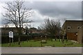
5
Stockholm Close, Danesholme
Off Viking Way.
Image: © Richard Vince
Taken: 18 Jan 2020
0.13 miles
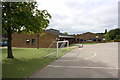
7
Trim trail at Danesholme Junior School
Image: © Blane Chalmers
Taken: 25 Feb 2007
0.14 miles
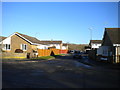
8

Garage block of Vara Close
There is an OS benchmark Image on the shaded face of the block at its right hand corner
Image: © phil Richards
Taken: 12 Sep 2019
0.14 miles
9

Benchmark on garage block beside Viking Way at Vara Close junction
Ordnance Survey cut mark benchmark described on the Bench Mark Database at www.bench-marks.org.uk/bm111633
Image: © phil Richards
Taken: 12 Sep 2019
0.14 miles