IMAGES TAKEN NEAR TO
Oakley Road, CORBY, NN18 8LH
Introduction
This page details the photographs taken nearby to Oakley Road, NN18 8LH by members of the Geograph project.
The Geograph project started in 2005 with the aim of publishing, organising and preserving representative images for every square kilometre of Great Britain, Ireland and the Isle of Man.

There are currently over 7.5m images from over14,400 individuals and you can help contribute to the project by visiting https://www.geograph.org.uk
Image Map (Loading...)


Getting Data...Please wait
Leaflet Map data © OpenStreetMap
Images are licensed for reuse under creativecommons.org/licenses/by-sa/2.0
Notes
- Clicking on the map will re-center to the selected point.
- The higher the marker number, the further away the image location is from the centre of the postcode.
Image Listing (24 Images Found)
Images are licensed for reuse under creativecommons.org/licenses/by-sa/2.0
Image
Details
Distance
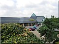
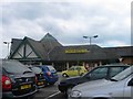
5
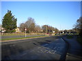
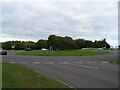
Oakley Road, Kingswood
Looking towards Corby town centre from outside the Morrisons supermarket.
Image: © Richard Vince
Taken: 18 Jan 2020
0.09 miles
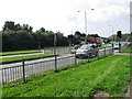
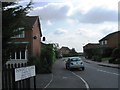
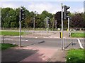
8
Garston Road, Lyveden Way, road junction
Image: © Alex McGregor
Taken: 2 Sep 2010
0.14 miles
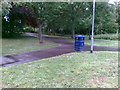
10
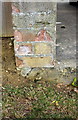
Benchmark on wall corner on NE side of Vancouver Close
Ordnance Survey cut mark benchmark described on the Bench Mark Database at www.bench-marks.org.uk/bm111636
Image: © phil Richards
Taken: 12 Sep 2019
0.14 miles