
IMAGES TAKEN NEAR TO
Rathlin Close, CORBY, NN17 2QU
Introduction
This page details the photographs taken nearby to Rathlin Close, NN17 2QU by members of the Geograph project.
The Geograph project started in 2005 with the aim of publishing, organising and preserving representative images for every square kilometre of Great Britain, Ireland and the Isle of Man.

There are currently over 7.5m images from over14,400 individuals and you can help contribute to the project by visiting https://www.geograph.org.uk
Image Map
Images are licensed for reuse under creativecommons.org/licenses/by-sa/2.0
Notes
- Clicking on the map will re-center to the selected point.
- The higher the marker number, the further away the image location is from the centre of the postcode.
Image Listing (26 Images Found)
Images are licensed for reuse under creativecommons.org/licenses/by-sa/2.0
Image
Details
Distance
1
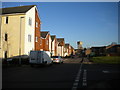
Harris Road, Lodge Park (1)
Home to some new housing and a small open space (left), with the water tower off Willow Brook Road visible in the distance.
Image: © Richard Vince
Taken: 18 Jan 2020
0.12 miles
2
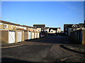
Road between garages off Skye Road, Lodge Park
Image: © Richard Vince
Taken: 18 Jan 2020
0.12 miles
3
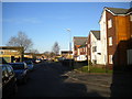
Harris Road, Lodge Park (2)
Lined with housing oldish and new.
Image: © Richard Vince
Taken: 18 Jan 2020
0.12 miles
4
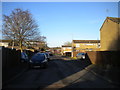
Skye Road, Lodge Park
Looking towards Shetland Way.
Image: © Richard Vince
Taken: 18 Jan 2020
0.14 miles
5
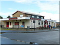
The Kingfisher
Estate pub of the same vintage as the surrounding housing, on the corner of Fotheringhay Road and Denford Road, West Corby.
Image: © Jonathan Billinger
Taken: 27 Jul 2009
0.14 miles
6
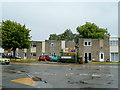
Housing on Shetland Way, Corby
1960's housing on the western outskirts of the town.
Image: © Jonathan Billinger
Taken: 27 Jul 2009
0.16 miles
7
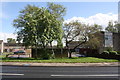
Brick wall on SE side of Shetland Way (opposite Fyfe Road)
The wall originally ran between two garage blocks of which only the concrete bases remain
Image: © Roger Templeman
Taken: 10 May 2019
0.16 miles
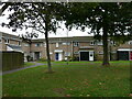
10
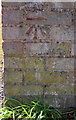
Benchmark on garage block on SW side of Fotheringhay Road
Ordnance Survey cut mark benchmark described on the Bench Mark Database at www.bench-marks.org.uk/bm107599
Image: © phil Richards
Taken: 10 May 2019
0.18 miles