
IMAGES TAKEN NEAR TO
Browning Walk, CORBY, NN17 2NF
Introduction
This page details the photographs taken nearby to Browning Walk, NN17 2NF by members of the Geograph project.
The Geograph project started in 2005 with the aim of publishing, organising and preserving representative images for every square kilometre of Great Britain, Ireland and the Isle of Man.

There are currently over 7.5m images from over14,400 individuals and you can help contribute to the project by visiting https://www.geograph.org.uk
Image Map
Images are licensed for reuse under creativecommons.org/licenses/by-sa/2.0
Notes
- Clicking on the map will re-center to the selected point.
- The higher the marker number, the further away the image location is from the centre of the postcode.
Image Listing (11 Images Found)
Images are licensed for reuse under creativecommons.org/licenses/by-sa/2.0
Image
Details
Distance
1
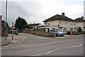
Nos.89 and 91 Willowbrook Road at road junction
There used to be public conveniences at the left hand side of this junction
Image: © Roger Templeman
Taken: 10 May 2019
0.13 miles
2
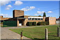
SE wing of Studfall Junior Academy, Rowlett Road
Image: © Roger Templeman
Taken: 13 Sep 2018
0.14 miles
4
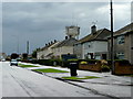
Willow Brook Road, Corby
1950's housing pictured just after and before a heavy rainstorm.
The water tower is in the next square south, Image See Image
Image: © Jonathan Billinger
Taken: 27 Jul 2009
0.15 miles
5
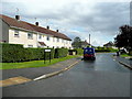
Coleridge Way, Corby
Looking south from Willow Brook Road.
Image: © Jonathan Billinger
Taken: 27 Jul 2009
0.21 miles
6
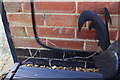
Benchmark on #147 Rowlett Road
Ordnance Survey cut mark benchmark described on the Bench Mark Database at https://www.bench-marks.org.uk/bm99579
Image: © Roger Templeman
Taken: 13 Sep 2018
0.22 miles
7
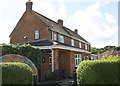
#147 Rowlett Road
There is an OS benchmark Image on the near corner of the house right of a cable
Image: © Roger Templeman
Taken: 13 Sep 2018
0.22 miles
8
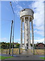
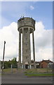
Water tower in suburban Corby
Situated north of Willow Brook Road in the north-west of the town.
Corby shows all the signs of its rapid expansion around the 1960's with a mix of infrastructure like this.
Image: © Jonathan Billinger
Taken: 27 Jul 2009
0.23 miles
10
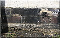
Benchmark on shed of #62 Willow Brook Road
Ordnance Survey cut mark benchmark described on the Bench Mark Database at www.bench-marks.org.uk/bm107557
Image: © phil Richards
Taken: 10 May 2019
0.24 miles