IMAGES TAKEN NEAR TO
Mill Road, KETTERING, NN14 3LB
Introduction
This page details the photographs taken nearby to Mill Road, NN14 3LB by members of the Geograph project.
The Geograph project started in 2005 with the aim of publishing, organising and preserving representative images for every square kilometre of Great Britain, Ireland and the Isle of Man.

There are currently over 7.5m images from over14,400 individuals and you can help contribute to the project by visiting https://www.geograph.org.uk
Image Map
Images are licensed for reuse under creativecommons.org/licenses/by-sa/2.0
Notes
- Clicking on the map will re-center to the selected point.
- The higher the marker number, the further away the image location is from the centre of the postcode.
Image Listing (25 Images Found)
Images are licensed for reuse under creativecommons.org/licenses/by-sa/2.0
Image
Details
Distance
2
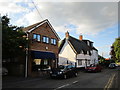
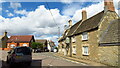
Lowick Road Islip
Looking south-east down Lowick Road to the Rose & Crown PH (closed at present) which stands at the junction of Mill Road and High Street. The Nene Way footpath goes down the pub garden.
Image: © Will Lovell
Taken: 30 Mar 2006
0.07 miles
5
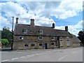
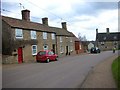
The Rose and Crown pub, Islip
The date (1691) is engraved in the stone above the doorway along with the initials E.C. See http://www.britishlistedbuildings.co.uk/en-232472-the-rose-and-crown-public-house-islip-no#.VXXs1c9Viko for entry in British Listed Buildings.
Image: © Bikeboy
Taken: 30 May 2015
0.08 miles
6
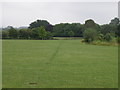
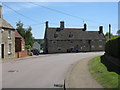
The Nene Way in Islip
The footpath runs through a field that has been taken on as a garden extension, hence the close cut grass.
Image: © Michael Trolove
Taken: 28 Jun 2009
0.09 miles
8
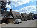
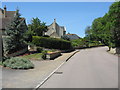
Seventeenth century house, High Street Islip
These limestone houses were built in C17. See http://www.britishlistedbuildings.co.uk/en-232479-23-high-street-islip-northamptonshire#.VXXqZs9Viko and http://www.britishlistedbuildings.co.uk/en-232480-25-and-27-high-street-islip-northamptons#.VXXqbc9Viko for entry in British Listed Buildings
Image: © Bikeboy
Taken: 30 May 2015
0.19 miles
9
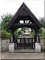
Lych Gate at Islip church
Viewed from High street.
Image: © Michael Trolove
Taken: 28 Jun 2009
0.19 miles