
IMAGES TAKEN NEAR TO
Churchill Way, BRACKLEY, NN13 7EJ
Introduction
This page details the photographs taken nearby to Churchill Way, NN13 7EJ by members of the Geograph project.
The Geograph project started in 2005 with the aim of publishing, organising and preserving representative images for every square kilometre of Great Britain, Ireland and the Isle of Man.

There are currently over 7.5m images from over14,400 individuals and you can help contribute to the project by visiting https://www.geograph.org.uk
Image Map
Images are licensed for reuse under creativecommons.org/licenses/by-sa/2.0
Notes
- Clicking on the map will re-center to the selected point.
- The higher the marker number, the further away the image location is from the centre of the postcode.
Image Listing (74 Images Found)
Images are licensed for reuse under creativecommons.org/licenses/by-sa/2.0
Image
Details
Distance
1
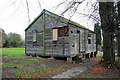
Magdalen College School, Brackley, Northants: the former CCF hut
This hut, now derelict, was used up to the 1960s by the Signals section of the school's Combined Cadet Force. To the west of it was a miniature rifle range, now demolished.
Image: © Philip Talmage
Taken: 10 Nov 2007
0.10 miles
2
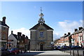
Brackley Town Hall
Looking southwards down Market Place.
Image: © Andrew Smith
Taken: 25 Mar 2006
0.12 miles
3

Magdalen Building
An ivy-clad building, part of Magdalen College School, High St, Brackley.
Image: © mick finn
Taken: 19 Oct 2008
0.13 miles
4
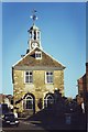
Town Hall, Brackley, Northants.
Brackley is a lovely little market town with a decent bookshop selling new and used books.
Image: © nick macneill
Taken: Unknown
0.13 miles
5
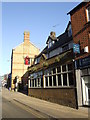
The Red Lion, Brackley
A Charles Wells lively, town pub now with added Youngs.
Image: © al partington
Taken: 24 Jan 2008
0.13 miles
6
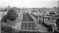
Brackley Town Station (remains)
View eastward, towards Buckingham, Verney Junction and Bletchley; ex-LNW Bletchley - Banbury line. The station was closed to passengers on 2/1/61 - less than three months before this photograph, in spite of an early experiment from 1956 with a single-unit Diesel railcar running between Buckingham and Banbury and calling also at two new Halts, which proved to be a success. The service was then cut back to Bletchley - Buckingham only (with the railcar) until 7/9/64. (Goods traffic on the branch ceased completely west of Buckingham on 2/12/63, from Bletchley on 5/12/66).
Image: © Ben Brooksbank
Taken: 24 Mar 1961
0.13 miles
7
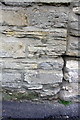
Benchmark on #4 Bridge Street
Ordnance Survey cut mark benchmark described on the Bench Mark Database at http://www.bench-marks.org.uk/bm48290
Image: © Roger Templeman
Taken: 22 Apr 2013
0.14 miles
8
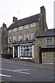
Orchid Dental Centre, #4 Bridge Street
There is an OS benchmark Image at the right hand side of the building, at its junction with the neighbouring shop.
Image: © Roger Templeman
Taken: 22 Apr 2013
0.14 miles
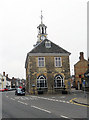
10
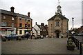
Brackley, Northants: market place and town hall
Image: © Philip Talmage
Taken: 10 Nov 2007
0.14 miles