
IMAGES TAKEN NEAR TO
Watling Street West, TOWCESTER, NN12 6AG
Introduction
This page details the photographs taken nearby to Watling Street West, NN12 6AG by members of the Geograph project.
The Geograph project started in 2005 with the aim of publishing, organising and preserving representative images for every square kilometre of Great Britain, Ireland and the Isle of Man.

There are currently over 7.5m images from over14,400 individuals and you can help contribute to the project by visiting https://www.geograph.org.uk
Image Map
Images are licensed for reuse under creativecommons.org/licenses/by-sa/2.0
Notes
- Clicking on the map will re-center to the selected point.
- The higher the marker number, the further away the image location is from the centre of the postcode.
Image Listing (112 Images Found)
Images are licensed for reuse under creativecommons.org/licenses/by-sa/2.0
Image
Details
Distance
2
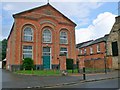
Baptist Chapel, Watling Street
Built in 1877
Image: © Eirian Evans
Taken: 18 Jul 2012
0.01 miles

4
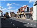
Watling Street, Towcester
Towcester is the site of the Roman town Lactodorum. The A5 follows the course of Watling Street.
Image: © Bikeboy
Taken: 21 Aug 2014
0.02 miles
6

Towcester from the air
The racecourse is visible on the right, Tove Valley is to the left of centre. Viewed from a Birmingham bound flight from Prague.
Image: © Thomas Nugent
Taken: 11 Feb 2022
0.05 miles
7
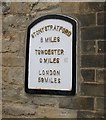
Old Milepost by the A5, Watling Street West, Towcester parish
Cast iron post by the A5, in parish of TOWCESTER (SOUTH NORTHAMPTONSHIRE District), Watling Street West, in wall next to No. 131, Bridge House just South of bridge over Silverstone Brook, set in stone wall of house, beside gate post, on Southwest side of road. Dunchurch iron plate, erected by the Old Stratford to Dunchurch turnpike trust in the 20th century.
Inscription reads:-
STONY STRATFORD
8 MILES
TOWCESTER 0 MILES
LONDON
59 MILES
Milestone Society National ID: NR_LH59.
Image: © A Rosevear
Taken: 2 Aug 2003
0.06 miles
8
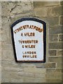
Mile plate, Towcester
Cast iron plate by the A5, in parish of Towcester (South Northamptonshire District), Watling Street West, in wall next to No. 131, Bridge House just S of bridge over Silverstone Brook, set in stone wall of house, beside gate post, on South-west side of road. Dunchurch iron plate, probably a C20 replica. Inscription reads: // STONY STRATFORD / 8 MILES / TOWCESTER 0 MILES / LONDON / 59 MILES //. Not listed by Historic England. Milestone Society National ID: NR_LH59. From National Survey of Wayside Features by The Milestone Society https://www.milestonesociety.co.uk/.
Image: © Mike Faherty
Taken: 6 Oct 2019
0.06 miles
9
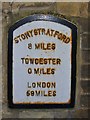
Towcester - Milepost
Historic metallic milepost on Watling Street, a former Roman road.
Image: © Colin Smith
Taken: 31 Jan 2016
0.06 miles
10
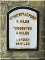
Old Milestone
Old milestone (metal plaque) mounted on house wall on the A5 at Towcester, Northamptonshire. For overall view see http://www.geograph.org.uk/photo/5381244
Image: © Keith Evans
Taken: 22 Apr 2017
0.06 miles