Mile plate, Towcester
Introduction
The photograph on this page of Mile plate, Towcester by Mike Faherty as part of the Geograph project.
The Geograph project started in 2005 with the aim of publishing, organising and preserving representative images for every square kilometre of Great Britain, Ireland and the Isle of Man.

There are currently over 7.5m images from over 14,400 individuals and you can help contribute to the project by visiting https://www.geograph.org.uk
Mile plate, Towcester
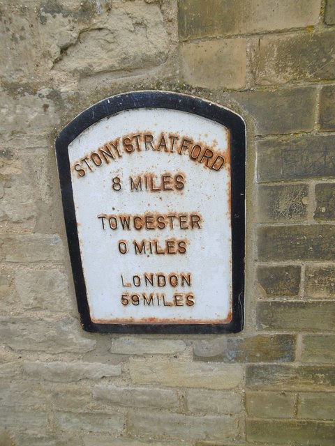
Image: © Mike Faherty Taken: 6 Oct 2019
Cast iron plate by the A5, in parish of Towcester (South Northamptonshire District), Watling Street West, in wall next to No. 131, Bridge House just S of bridge over Silverstone Brook, set in stone wall of house, beside gate post, on South-west side of road. Dunchurch iron plate, probably a C20 replica. Inscription reads: // STONY STRATFORD / 8 MILES / TOWCESTER 0 MILES / LONDON / 59 MILES //. Not listed by Historic England. Milestone Society National ID: NR_LH59. From National Survey of Wayside Features by The Milestone Society https://www.milestonesociety.co.uk/.
Images are licensed for reuse under creativecommons.org/licenses/by-sa/2.0
Image Location
Latitude
52.130362
Longitude
-0.986983