
IMAGES TAKEN NEAR TO
Haddenstone Close, DAVENTRY, NN11 8BT
Introduction
This page details the photographs taken nearby to Haddenstone Close, NN11 8BT by members of the Geograph project.
The Geograph project started in 2005 with the aim of publishing, organising and preserving representative images for every square kilometre of Great Britain, Ireland and the Isle of Man.

There are currently over 7.5m images from over14,400 individuals and you can help contribute to the project by visiting https://www.geograph.org.uk
Image Map
Images are licensed for reuse under creativecommons.org/licenses/by-sa/2.0
Notes
- Clicking on the map will re-center to the selected point.
- The higher the marker number, the further away the image location is from the centre of the postcode.
Image Listing (19 Images Found)
Images are licensed for reuse under creativecommons.org/licenses/by-sa/2.0
Image
Details
Distance
1
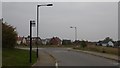
Farnborough Drive, Middlemore
Looking northeast at Farnborough Drive, Middlemore in Daventry. Near Heartlands Business Park and the dismantled railway path.
Image: © Jareth W
Taken: 3 Oct 2015
0.07 miles
2
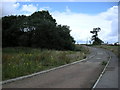
Daventry-Drayton Fields
The lane to Middlemore crosses the Leamington-Weedon line behind the trees
Image: © Ian Rob
Taken: 8 Jul 2008
0.10 miles
3
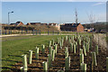
Middlemore
Considerable efforts are being made here to ensure that this new estate will have plenty of trees. The houses are gradually encroaching although they haven't yet reached this far. Middlemore is built on a hillside to the north of Daventry; from this point the land falls away to Drayton Reservoir.
Image: © Stephen McKay
Taken: 6 Jan 2008
0.13 miles
4
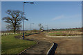
Claydon Road, Middlemore
There is something peculiarly desolate about land waiting for the developers' bulldozers, with roads to nowhere, hints of encroaching urbanisation and the eerie sense that something is about to be lost forever. This is the furthest part of the Middlemore housing development where the buildings have not yet reached.
Image: © Stephen McKay
Taken: 6 Jan 2008
0.13 miles
5

Daventry Bridleway
The Bridleway from Braunston Road to Ashby Road crosses the dismantled Leamington-Weedon line near Middlemore.
Image: © Ian Rob
Taken: 29 Jan 2011
0.14 miles
6

Daventry-Dismantled Leamington to Weedon Railway
The high viaduct carrying the bridleway over the deep cutting.
Image: © Ian Rob
Taken: 29 Jan 2011
0.14 miles
7

Daventry-Dismantled Leamington to Weedon Railway
A five arch viaduct carries the bridleway across the deep overgrown cutting.
Image: © Ian Rob
Taken: 29 Jan 2011
0.14 miles
8
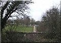
Daventry-Heartlands Business Park
The view from the bridge on the dismantled railway.
Image: © Ian Rob
Taken: 29 Jan 2011
0.17 miles
9

Daventry-Heartlands Business Park
Access bridge under the dismantled railway.
Image: © Ian Rob
Taken: 29 Jan 2011
0.17 miles
10
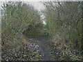
Daventry-Dismantled Leamington to Weedon Railway
The surfaced footpath reverts back to overgrown trackbed,
Image: © Ian Rob
Taken: 12 Feb 2010
0.17 miles