IMAGES TAKEN NEAR TO
Lindrick Close, DAVENTRY, NN11 4SN
Introduction
This page details the photographs taken nearby to Lindrick Close, NN11 4SN by members of the Geograph project.
The Geograph project started in 2005 with the aim of publishing, organising and preserving representative images for every square kilometre of Great Britain, Ireland and the Isle of Man.

There are currently over 7.5m images from over14,400 individuals and you can help contribute to the project by visiting https://www.geograph.org.uk
Image Map
Images are licensed for reuse under creativecommons.org/licenses/by-sa/2.0
Notes
- Clicking on the map will re-center to the selected point.
- The higher the marker number, the further away the image location is from the centre of the postcode.
Image Listing (7 Images Found)
Images are licensed for reuse under creativecommons.org/licenses/by-sa/2.0
Image
Details
Distance
1
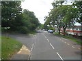
Daventry: Admirals Way
This is the view looking south at the junction with Birkdale Close from the upper deck of a D1 bus bound for Northampton.
Image: © Nigel Cox
Taken: 29 Jun 2015
0.12 miles
2
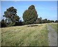
Daventry-Borough Hill
The path along the west side of the hill.
Image: © Ian Rob
Taken: 18 Oct 2009
0.12 miles
3
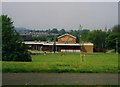
The Golden Hind public house
The Golden Hind public house had a short life being built on the Southbrook estate in the early 1970's and being demolished in the late 1990's to make way for housing. The pub had a notorious reputation.
Image: © Mark Hobbs
Taken: 29 May 1992
0.12 miles
6
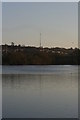
The last of many
The last of the BBC masts on Borough Hill Daventry. The masts use to transmit the BBC World Service. It is also said that this is the place where the Kings troop camped before the battle of Naseby.
Image: © Richard Smith
Taken: 6 Dec 2008
0.24 miles