
IMAGES TAKEN NEAR TO
Borough Hill, DAVENTRY, NN11 4NA
Introduction
This page details the photographs taken nearby to Borough Hill, NN11 4NA by members of the Geograph project.
The Geograph project started in 2005 with the aim of publishing, organising and preserving representative images for every square kilometre of Great Britain, Ireland and the Isle of Man.

There are currently over 7.5m images from over14,400 individuals and you can help contribute to the project by visiting https://www.geograph.org.uk
Image Map
Images are licensed for reuse under creativecommons.org/licenses/by-sa/2.0
Notes
- Clicking on the map will re-center to the selected point.
- The higher the marker number, the further away the image location is from the centre of the postcode.
Image Listing (11 Images Found)
Images are licensed for reuse under creativecommons.org/licenses/by-sa/2.0
Image
Details
Distance
1
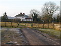
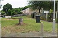
Daventry - Borough Hill
House on southern edge of this square, taken from car park for the picnic site.
Image: © Ian Rob
Taken: 12 Jan 2006
0.02 miles
2
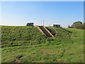
Daventry-Borough Hill Storage Reservoir
Underground storage reservoir just south of the transmitting station.
Image: © Ian Rob
Taken: 29 Sep 2011
0.06 miles
3
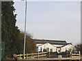
Daventry - Borough Hill
Part of BBC Transmitting Station on the Hill
Image: © Ian Rob
Taken: 12 Jan 2006
0.07 miles
4
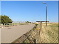
Daventry-Borough Hill
Road leading up to the former BBC site which is now owned by Arqiva.
Image: © Ian Rob
Taken: 29 Sep 2011
0.12 miles
6
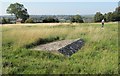
Daventry-Borough Hill
Overlooking the town.
Image: © Ian Rob
Taken: 29 Sep 2011
0.18 miles
7

Overgrown and wet bridleway
A lightly used bridleway near Daventry.
Image: © Michael Trolove
Taken: 3 Feb 2013
0.20 miles
8
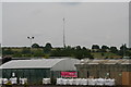
Borough Hill mast viewed across a garden centre
Borough Hill is now a Country Park. It is the site of the well-known Daventry masts (11 of them) alongside the M1, which were originally long wave and short wave transmitters.
Arnold Frederic Wilkins demonstrated radar, from radio waves from the Borough Hill transmitter on 26 February 1935.
This one remaining mast is mainly used for Microwave communications, cell phone antennas and TETRA.
See http://www.derelictplaces.co.uk/main/showthread.php?t=19657#.U7SP55RdWk0 and http://en.wikipedia.org/wiki/Weedon_Bec
Image: © Chris
Taken: 2 Jul 2014
0.23 miles
9
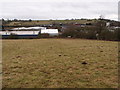
Daventry industrial area
Newnham Hill is in the distance.
Image: © Michael Trolove
Taken: 3 Feb 2013
0.23 miles
10
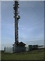
Daventry-Borough Hill
The base and lower section of the remaining transmitter on the hill.
Image: © Ian Rob
Taken: 18 Oct 2009
0.24 miles