
IMAGES TAKEN NEAR TO
The Glebe, DAVENTRY, NN11 3AZ
Introduction
This page details the photographs taken nearby to The Glebe, NN11 3AZ by members of the Geograph project.
The Geograph project started in 2005 with the aim of publishing, organising and preserving representative images for every square kilometre of Great Britain, Ireland and the Isle of Man.

There are currently over 7.5m images from over14,400 individuals and you can help contribute to the project by visiting https://www.geograph.org.uk
Image Map
Images are licensed for reuse under creativecommons.org/licenses/by-sa/2.0
Notes
- Clicking on the map will re-center to the selected point.
- The higher the marker number, the further away the image location is from the centre of the postcode.
Image Listing (51 Images Found)
Images are licensed for reuse under creativecommons.org/licenses/by-sa/2.0
Image
Details
Distance
1
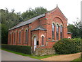
Badby United Reformed Church
In Chapel Lane.
Image: © Ian Rob
Taken: 23 Aug 2008
0.05 miles
2
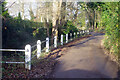
Brookside Lane, Badby
Brookside Lane skirts the eastern side of Badby connecting Church Green with Chapel Lane. The brook runs alongside the lower part of the lane and is a tributary of the River Nene which passes just north of the village (and is itself no more than a small stream in this area).
Image: © Stephen McKay
Taken: 5 Jan 2022
0.05 miles
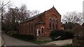
4
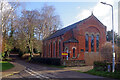
Badby United Reformed Church
The chapel on Chapel Lane dates from 1873 and was built by Edwin Briggs. It held its last service in July 2021 and was placed on the market shortly afterwards. Sales particulars gave a guide price of £300,000 and described it as a 'restoration project', although planning permission would be needed for a change of use. The board outside in this view indicates that it has been sold.
Image: © Stephen McKay
Taken: 5 Jan 2022
0.05 miles
5
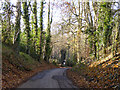
Sunken lane descending into Badby
Chapel Lane is the way in from Everdon.
Image: © Robin Webster
Taken: 4 Dec 2016
0.08 miles
6
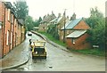
Vicarage Hill, Badby in 1987
The road's nameplate can be seen on the right side of the frame
Image: © John Baker
Taken: 9 Oct 1987
0.08 miles
7
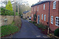
Brookside Lane, Badby
Brookside Lane leads down from Church Green towards Chapel Lane on the eastern side of Badby village.
Image: © Stephen McKay
Taken: 5 Jan 2022
0.08 miles
8
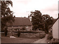
Brookside Lane, Badby
Brookside Lane forms part of the Nene Way long distance footpath along the River Nene, as it passes through Badby.The picture features the building that once served as Badby Youth Hostel, before the hostel closed in 2005
Image: © Alan Kent
Taken: 21 Sep 2016
0.08 miles
9
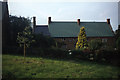
Former Badby Youth Hostel
The green tin roof is now thatched.
Image: © Colin Park
Taken: 19 Jul 1980
0.08 miles
10
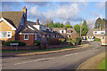
Park Close, Badby
Park Close leads off Chapel Lane on the edge of Badby and consists of semi-detached dormer-style bungalows.
Image: © Stephen McKay
Taken: 5 Jan 2022
0.09 miles