IMAGES TAKEN NEAR TO
Coniston Close, RUSHDEN, NN10 8NL
Introduction
This page details the photographs taken nearby to Coniston Close, NN10 8NL by members of the Geograph project.
The Geograph project started in 2005 with the aim of publishing, organising and preserving representative images for every square kilometre of Great Britain, Ireland and the Isle of Man.

There are currently over 7.5m images from over14,400 individuals and you can help contribute to the project by visiting https://www.geograph.org.uk
Image Map
Images are licensed for reuse under creativecommons.org/licenses/by-sa/2.0
Notes
- Clicking on the map will re-center to the selected point.
- The higher the marker number, the further away the image location is from the centre of the postcode.
Image Listing (12 Images Found)
Images are licensed for reuse under creativecommons.org/licenses/by-sa/2.0
Image
Details
Distance
1

Footbridge below Higham Ferrers
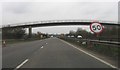
The footbridge carries Kings Meadow Lane over the A45 bypass, giving access to the riverside paths, old gravel pits and the footpath to Irthlingborough. The River Nene (pronounced 'Nen' hereabouts) is in the foreground.
Image: © Will Lovell
Taken: 13 Dec 2005
0.12 miles
4
School Lane
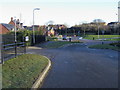
School Lane by Henry Chichele Primary School
Image: © Shaun Ferguson
Taken: 10 Dec 2008
0.14 miles
6
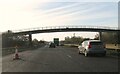
Station Road (A5028) approaching Chowns Mill Roundabout
Image: © JThomas
Taken: 23 Sep 2022
0.19 miles
8
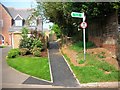
Footpath VC6, Higham Ferrers
The footpath used to run along the edge of a field, but a new housing estate has sprung up, and the County Council Rights of Way department had the path tarmaced.
Image: © Will Lovell
Taken: 9 May 2006
0.22 miles
9
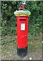
Yarn bombed George V postbox on Windmill Banks
Postbox No. NN10 37.
Image: © JThomas
Taken: 23 Sep 2022
0.23 miles