IMAGES TAKEN NEAR TO
Hickton Drive, NOTTINGHAM, NG9 6DD
Introduction
This page details the photographs taken nearby to Hickton Drive, NG9 6DD by members of the Geograph project.
The Geograph project started in 2005 with the aim of publishing, organising and preserving representative images for every square kilometre of Great Britain, Ireland and the Isle of Man.

There are currently over 7.5m images from over14,400 individuals and you can help contribute to the project by visiting https://www.geograph.org.uk
Image Map
Images are licensed for reuse under creativecommons.org/licenses/by-sa/2.0
Notes
- Clicking on the map will re-center to the selected point.
- The higher the marker number, the further away the image location is from the centre of the postcode.
Image Listing (44 Images Found)
Images are licensed for reuse under creativecommons.org/licenses/by-sa/2.0
Image
Details
Distance
2
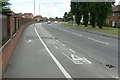
Swiney Way
The major distributor road created for the redeveloped Chilwell Ordnance Depot site. At this point it forms part of the Sustrans route 6.
Image: © Alan Murray-Rust
Taken: 24 Jun 2010
0.03 miles
3
Roundabout at Swiney Way
Redevelopment on the former Chilwell Ordnance Depot site.
Image: © Alan Murray-Rust
Taken: 24 Jun 2010
0.06 miles
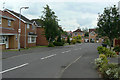
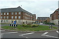
4
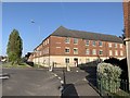
Thompson Court
From the junction of Ranson Road and Woodward Avenue.
Image: © Andrew Abbott
Taken: 22 Apr 2020
0.06 miles
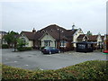
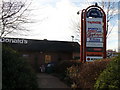
5
Cornmill Pub Chilwell on Nottingham Road
Image: © Andy Jamieson
Taken: 23 Nov 2008
0.06 miles
6
West Point Shopping Centre on Nottingham Road
Image: © Andy Jamieson
Taken: 23 Nov 2008
0.06 miles
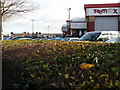
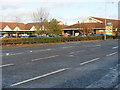
7
Fast food and retail therapy
Chilwell retail Park
Image: © Andy Jamieson
Taken: 23 Nov 2008
0.06 miles
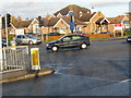
8
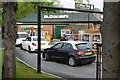
The queue for the McDonald's Drive Thru
Why oh why oh why?
Image: © David Lally
Taken: 19 May 2017
0.07 miles