IMAGES TAKEN NEAR TO
Milton Crescent, NOTTINGHAM, NG9 6BE
Introduction
This page details the photographs taken nearby to Milton Crescent, NG9 6BE by members of the Geograph project.
The Geograph project started in 2005 with the aim of publishing, organising and preserving representative images for every square kilometre of Great Britain, Ireland and the Isle of Man.

There are currently over 7.5m images from over14,400 individuals and you can help contribute to the project by visiting https://www.geograph.org.uk
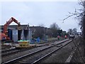
Image Map
Images are licensed for reuse under creativecommons.org/licenses/by-sa/2.0
Notes
- Clicking on the map will re-center to the selected point.
- The higher the marker number, the further away the image location is from the centre of the postcode.
Image Listing (73 Images Found)
Images are licensed for reuse under creativecommons.org/licenses/by-sa/2.0
Image
Details
Distance
1
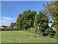
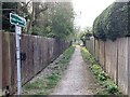
Footpaths on the playing fields
Between Attenborough and Chilwell
Image: © Andrew Abbott
Taken: 30 Apr 2020
0.07 miles
2
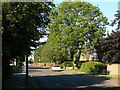
Long Lane, Attenborough
This was the 'back' road into the village from the east. The housing development largely dates from after the second World War.
Image: © Alan Murray-Rust
Taken: 1 Jun 2009
0.08 miles
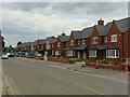
3
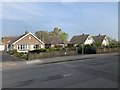
39-39 Long Lane, Attenborough
Housing on the edge of Attenborough village.
Image: © Andrew Abbott
Taken: 11 Apr 2020
0.09 miles
4
Footpath to the level crossing
From Long Lane near Attenborough.
Image: © Andrew Abbott
Taken: 11 Apr 2020
0.09 miles
5

Footpath across the railway
Running between Long Lane and Allendale Avenue
Image: © Alan Murray-Rust
Taken: 1 Jun 2009
0.11 miles
6
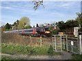
Cross Country train at Attenborough
An empty coaching stock movement from Leicester to Nottingham. Headcode 5G09. Train 170397.
Image: © Andrew Abbott
Taken: 9 Apr 2020
0.12 miles
7
Chaucer Mews, Long Lane, Attenborough
New housing development on the site of the former sand and gravel works https://www.geograph.org.uk/photo/929166
Image: © Alan Murray-Rust
Taken: 26 Apr 2022
0.12 miles
8
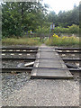
Footpath Level Crossing
There are quite a few of these on the line between Long Eaton and Beeston.
Image: © David Lally
Taken: 24 Jul 2009
0.12 miles
9
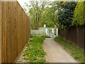
Footpath to the railway, Attenborough
The fence on the left has been increased in height since my 2009 view https://www.geograph.org.uk/photo/1338333 , and the timber gates have also been replaced with steel ones.
Image: © Alan Murray-Rust
Taken: 26 Apr 2022
0.12 miles