IMAGES TAKEN NEAR TO
Humber Road, NOTTINGHAM, NG9 2EF
Introduction
This page details the photographs taken nearby to Humber Road, NG9 2EF by members of the Geograph project.
The Geograph project started in 2005 with the aim of publishing, organising and preserving representative images for every square kilometre of Great Britain, Ireland and the Isle of Man.

There are currently over 7.5m images from over14,400 individuals and you can help contribute to the project by visiting https://www.geograph.org.uk
Image Map
Images are licensed for reuse under creativecommons.org/licenses/by-sa/2.0
Notes
- Clicking on the map will re-center to the selected point.
- The higher the marker number, the further away the image location is from the centre of the postcode.
Image Listing (413 Images Found)
Images are licensed for reuse under creativecommons.org/licenses/by-sa/2.0
Image
Details
Distance
1
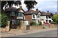
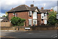
5, 7, and 9 Humber Road, Beeston
Detached houses.
Image: © Andrew Abbott
Taken: 6 Jun 2020
0.01 miles
2
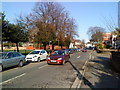
Humber Road, Beeston
Houses on Humber Road, Beeston
Image: © Andrew Abbott
Taken: 26 Mar 2010
0.02 miles
3
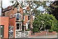
1 Humber Road, Beeston
A late Victorian house
Image: © Andrew Abbott
Taken: 6 Jun 2020
0.02 miles
4
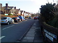
Coventry Road, Beeston
Houses on Coventry Road, Beeston
Image: © Andrew Abbott
Taken: 26 Mar 2010
0.03 miles
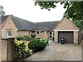
5
15 and 17 Humber Road, Beeston
Detached houses.
Image: © Andrew Abbott
Taken: 6 Jun 2020
0.04 miles
6
Humber Road, Beeston
House on Humber Road, Beeston
Image: © Andrew Abbott
Taken: 26 Mar 2010
0.04 miles
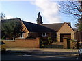
8
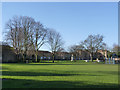
Broadgate Park, Beeston
The main area of open space close to the town centre. The park has recently been designated as a Queen Elizabeth II Field http://www.fieldsintrust.org/QEII.aspx
Image: © Alan Murray-Rust
Taken: 13 Jan 2014
0.04 miles
9
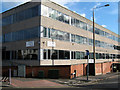
Broadgate House
On the corner of Bradgate and Humber Road, Beeston.
These were thirty years ago offices of Broxtowe Borough Council. Presumably sold-off when the new building was completed on Foster Avenue http://www.geograph.org.uk/photo/1016394.
Image: © David Lally
Taken: 13 Feb 2009
0.05 miles
10
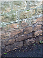
Bench mark, The City, Beeston
See http://www.geograph.org.uk/photo/3816872 for location.
Image: © Alan Murray-Rust
Taken: 13 Jan 2014
0.05 miles