IMAGES TAKEN NEAR TO
Rookwood Close, NOTTINGHAM, NG9 1FS
Introduction
This page details the photographs taken nearby to Rookwood Close, NG9 1FS by members of the Geograph project.
The Geograph project started in 2005 with the aim of publishing, organising and preserving representative images for every square kilometre of Great Britain, Ireland and the Isle of Man.

There are currently over 7.5m images from over14,400 individuals and you can help contribute to the project by visiting https://www.geograph.org.uk
Image Map
Images are licensed for reuse under creativecommons.org/licenses/by-sa/2.0
Notes
- Clicking on the map will re-center to the selected point.
- The higher the marker number, the further away the image location is from the centre of the postcode.
Image Listing (562 Images Found)
Images are licensed for reuse under creativecommons.org/licenses/by-sa/2.0
Image
Details
Distance
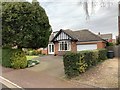
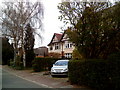
1
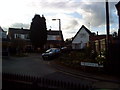
Rookwood Close, Beeston
Housing on Rookwood Close, Beeston.
Image: © Andrew Abbott
Taken: 26 Mar 2010
0.02 miles
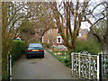
3
34 Park Road, Chilwell
In the Cottage Grove Conservation Area.
Image: © Andrew Abbott
Taken: 6 Apr 2020
0.03 miles
4
40 and 42 Park Road, Chilwell
Jubilee Villas of 1887. In the Cottage Grove Conservation Area.
Image: © Andrew Abbott
Taken: 6 Apr 2020
0.03 miles
5
26 Park Road, Chilwell
In the Cottage Grove Conservation Area.
Image: © Andrew Abbott
Taken: 6 Apr 2020
0.03 miles
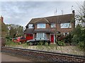
6
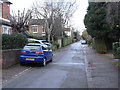
Park Road, Chilwell
The narrow roads in this area were developed from around 1885 before any thought for the needs of motorised traffic.
Image: © Alan Murray-Rust
Taken: 22 Dec 2013
0.03 miles
7
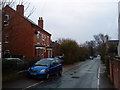
Park Road, Beeston
View of Park Road in Beeston looking south. This street is part of a conservation area.
Image: © Andrew Abbott
Taken: 24 Mar 2010
0.03 miles
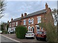
8
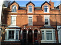
Collington Street, Beeston
Attractive gothic details on Victorian housing on Collington Street, Beeston.
Image: © Andrew Abbott
Taken: 26 Mar 2010
0.04 miles
10
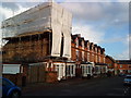
Collington Street, Beeston
The house under scaffolding suffered a fire on 30 January 2010. The residents been growing cannabis in the roof space, and it is thought that the equipment used to propagate the plants caused the fire. The roof collapsed.
Image: © Andrew Abbott
Taken: 26 Mar 2010
0.04 miles