
IMAGES TAKEN NEAR TO
Addington Road, NOTTINGHAM, NG7 5PA
Introduction
This page details the photographs taken nearby to Addington Road, NG7 5PA by members of the Geograph project.
The Geograph project started in 2005 with the aim of publishing, organising and preserving representative images for every square kilometre of Great Britain, Ireland and the Isle of Man.

There are currently over 7.5m images from over14,400 individuals and you can help contribute to the project by visiting https://www.geograph.org.uk
Image Map
Images are licensed for reuse under creativecommons.org/licenses/by-sa/2.0
Notes
- Clicking on the map will re-center to the selected point.
- The higher the marker number, the further away the image location is from the centre of the postcode.
Image Listing (163 Images Found)
Images are licensed for reuse under creativecommons.org/licenses/by-sa/2.0
Image
Details
Distance
1
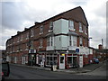
Terraced houses and shops, Hartley Road, Radford
The former corner shop is now occupied by the Jukebox Cafe, a 1950s American style diner.
Image: © Richard Vince
Taken: 1 Feb 2013
0.03 miles
2

Radford: up Hartley Road
Looking towards Alfreton Road on a bright September morning. Three-storey houses like these were built in huge numbers in Nottingham in the last quarter of the nineteenth century.
Image: © John Sutton
Taken: 12 Sep 2019
0.03 miles
3
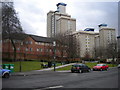
Open space on Hartley Road, Radford
This open space on the south side of Hartley Road in Radford may have been the site of a turning circle used by buses on the old Nottingham City Transport route 58, which terminated hereabouts. The old 58 replaced the trams between here and Nottingham city centre via Radford, Lenton and Castle Boulevards, but was itself replaced by circular routes 8 and 9 around 1980, meaning buses no longer terminated here. The distinctively styled high rise flats in the background stand out all the more thanks to the rarity of such structures in Nottingham.
Image: © Richard Vince
Taken: 1 Feb 2013
0.04 miles
4

The Colonel Burnaby, Radford
Now looking rather out of place being dwarfed by blocks of high rise flats, the Colonel Burnaby is in a similar situation to many inner city pubs that survived slum clearance projects. It is located on Hartley Road at its junction with Denison Street (left).
Image: © Richard Vince
Taken: 1 Feb 2013
0.04 miles
5
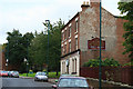
The Colonel Burnaby
Victorian pub on Hartley Road, Radford. Featuring the ghost of a painted sign. An opposing view here: Image
Image: © David Lally
Taken: 5 Oct 2010
0.04 miles
6
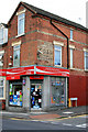
Radford News Centre
On the corner of Hartley Road and Crewe Close. With a fading painted advertisement for a coal merchant.
Image: © David Lally
Taken: 5 Oct 2010
0.05 miles
7
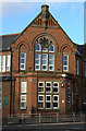
Alfreton Road School
Nottingham School Board, 1886. Now renamed Bentinck Primary School.
Image: © Alan Murray-Rust
Taken: 7 Nov 2008
0.06 miles
8
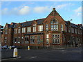
Bentinck Primary School
Former Alfreton Road School of the Nottingham Schools Board.
Image: © Alan Murray-Rust
Taken: 7 Nov 2008
0.06 miles
9
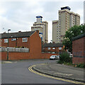
Radford contrast
These flats and houses, seen from Norton Street, replaced Victorian terraces late in the twentieth century.
Image: © John Sutton
Taken: 25 Aug 2021
0.07 miles
10
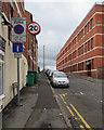
Radford: Beckenham Road
The building on the right was originally one of the more recent of the Player's tobacco factories in Radford (and after demolition and more recent fire destruction the last remaining). It is now an office block known as New Brook House.
Image: © John Sutton
Taken: 8 Jul 2015
0.07 miles