1
Radford Road shops in Hyson Green
Hyson Green has the largest ethnic minority population in Nottingham and this is seen in the multicultural shops on Radford Road.
Image: © Graham Hogg
Taken: 10 Mar 2014
0.04 miles
2
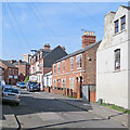
Hyson Green: Acourt Street
The building on the right, now a mosque, was originally, according to Robert Mellors' "Old Nottingham suburbs: then and now" (1914), a handicraft centre, one of the many council schools - including Bentinck Road, Berridge Road, Scotholme and Forster Street - built in Radford following the Forster Education Act of 1870.
Image: © John Sutton
Taken: 20 Nov 2009
0.05 miles
3
Peveril Street
Of most historical interest is the early 19th-century house with framework-knitter's windows on its third storey (above the red car). These large windows were essential to give the hand-loom weavers enough light. The Alfreton Road frontage of the house is shown in Alan Murray-Rust's photograph of the Alma Inn http://www.geograph.org.uk/photo/1044403. This photograph is also notable in showing the then home, on the left, of the alluring fellow student who shared the Forest Fields Grammar School 0-level English prize with me in 1964.
Image: © John Sutton
Taken: 16 Apr 2010
0.05 miles
4
Former National Provincial Bank at corner of Radford Road and Bentinck Road
It is suggested that this may have been most recently an Indian bank, but originally it seems to have been opened by the National Provincial Bank after 1918, and became a National Westminster Bank branch after Westminster and National Provincial merged about 1967.
Image: © Chris Morgan
Taken: 10 Mar 2014
0.05 miles
5
Hyson Green - the former Staddons store
Older people will remember the Staddons furnishing store and its huge clock on the Radford Road side, above the main door. The white panel above the windows on the Caulton Street facade once carried the Staddon name, in large, flourishing letters.
Image: © John Sutton
Taken: 20 Nov 2009
0.05 miles
6
Lake Street
A view from the corner of Southey Street, taken on the sunny morning of midsummer day.
Image: © John Sutton
Taken: 21 Jun 2017
0.05 miles
7
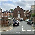
Radford: Aspley Place
Looking from Bentinck Road towards the backs of Victorian and twentieth-century houses on Peveril Street.
Image: © John Sutton
Taken: 25 Aug 2021
0.06 miles
8
Hyson Green: Acourt Street
Image: © John Sutton
Taken: 20 Nov 2009
0.06 miles
9
Up Southey Street
Taken from the corner of Lake Street on a brilliant June morning.
Image: © John Sutton
Taken: 21 Jun 2017
0.06 miles
10
Radford: The Alma and Alfreton Road
A view from the corner of Bentinck Road (left) and Alfreton Road. The early 19th-century house next to the closed pub has third-floor frame-knitter's windows.
Image: © John Sutton
Taken: 25 Aug 2021
0.07 miles


