
IMAGES TAKEN NEAR TO
Clayton Court, NOTTINGHAM, NG7 3HU
Introduction
This page details the photographs taken nearby to Clayton Court, NG7 3HU by members of the Geograph project.
The Geograph project started in 2005 with the aim of publishing, organising and preserving representative images for every square kilometre of Great Britain, Ireland and the Isle of Man.

There are currently over 7.5m images from over14,400 individuals and you can help contribute to the project by visiting https://www.geograph.org.uk
Image Map
Images are licensed for reuse under creativecommons.org/licenses/by-sa/2.0
Notes
- Clicking on the map will re-center to the selected point.
- The higher the marker number, the further away the image location is from the centre of the postcode.
Image Listing (177 Images Found)
Images are licensed for reuse under creativecommons.org/licenses/by-sa/2.0
Image
Details
Distance
1
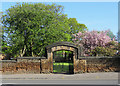
Ilkeston Road: the gate to Christ Church Gardens
A view across Ilkeston Road. The church was demolished in 1951. "Today we can still walk into the pleasant former churchyard, part of which is a children’s recreation ground and part a Garden of Rest, entered through the same iron gates set into the same Bulwell Stone wall. Part of the south wall of the nave has been left for us to see a little of the glory that was Christ Church" (The Southwell & Nottingham Church history Project website).
Image: © John Sutton
Taken: 5 May 2018
0.03 miles
2
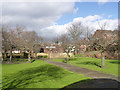
Christ Church Rest Garden
Created on the graveyard of the former Christ Church which was closed in 1943 and demolished in 1951.
Image: © Alan Murray-Rust
Taken: 16 Feb 2014
0.03 miles
3
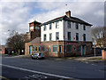
The Old Peacock
Former public house http://www.geograph.org.uk/photo/86507 which has been vacant for some time.
Image: © Alan Murray-Rust
Taken: 16 Feb 2014
0.04 miles
4
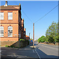
Down Ilkeston Road on a May morning
The former Douglas Junior School, Grade II listed and typical of schools built as a result of the 1870 Education Act, is on the left, on the corner of Seely Road.
Image: © John Sutton
Taken: 5 May 2018
0.05 miles
5
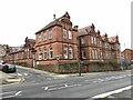
Douglas Primary School, Ilkeston Road, Nottingham
Grade II listed. Listing number 1254508. Built 1882-83. Architect Abraham Harrison Goodall.
Image: © Andrew Abbott
Taken: 31 Jan 2021
0.06 miles
6
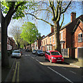
Up Albert Grove
One of the steep, leafy streets between Ilkeston Road and Derby Road (ahead), photographed on a fine May morning.
Image: © John Sutton
Taken: 5 May 2018
0.06 miles
7
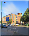
Radford: the rebuilt Viyella factory
Image: © John Sutton
Taken: 12 Sep 2019
0.06 miles
8
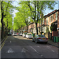
Up Douglas Road
One of the steep, leafy streets between Ilkeston Road and Derby Road (ahead), photographed on a fine May morning.
Image: © John Sutton
Taken: 5 May 2018
0.07 miles
9
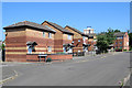
Radford: Wolsey Avenue
Nottingham's first response to slum clearance in New Radford and other inner-city suburbs was to build high-rise and deck-access flats. A more enlightened approach in later years was to build small houses with gardens.
Image: © John Sutton
Taken: 28 Jun 2018
0.07 miles
10
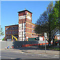
Ilkeston Road: the former Viyella factory
The distinctive tower of the former Viyella works has been a Radford landmark since 1900. The intention is to create more than 300 residential units.
Image: © John Sutton
Taken: 5 May 2018
0.08 miles