IMAGES TAKEN NEAR TO
Ilkeston Road, NOTTINGHAM, NG7 3GD

Introduction

This page details the photographs taken nearby to Ilkeston Road, NG7 3GD by members of the Geograph project.

The Geograph project started in 2005 with the aim of publishing, organising and preserving representative images for every square kilometre of Great Britain, Ireland and the Isle of Man.

There are currently over 7.5m images from over14,400 individuals and you can help contribute to the project by visiting https://www.geograph.org.uk

Image Map


Images are licensed for reuse under creativecommons.org/licenses/by-sa/2.0
Notes
  • Clicking on the map will re-center to the selected point.
  • The higher the marker number, the further away the image location is from the centre of the postcode.

Image Listing (440 Images Found)

Images are licensed for reuse under creativecommons.org/licenses/by-sa/2.0
  • ...
Image
Details
Distance
1
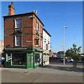
Shops on Ilkeston Road
Image: © JThomas Taken: 9 Jul 2016
0.00 miles
2
Steelwork at the top of Ilkeston Road
This little section of Ilkeston Road was cut off from the rest (ahead) when the Canning Circus one-way system was created many years ago.
Image: © John Sutton Taken: 29 Aug 2017
0.00 miles
3
3 to 9, Ilkeston Road, Nottingham
A group of late 18th century houses on the truncated traffic-free section of Ilkeston Road at Canning Circus. Listed Grade II.
Image: © Alan Murray-Rust Taken: 26 Jul 2019
0.01 miles
4
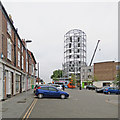
Building work at the top of Ilkeston Road
More new student accommodation is going up. For comparison, see Image] (August 2017).
Image: © John Sutton Taken: 5 May 2018
0.01 miles
5
Ilkeston Road: student flats nearer completion
Earlier views: Image] Image]
Image: © John Sutton Taken: 6 Sep 2018
0.01 miles
6
Nottingham - NG7 (Canning Circus)
Ilkeston Road is clearly not a through-road any longer. Although this cul-de-sac at the side of the well-known Sir John Borlase Warren pub 'seems' a calm oasis, in fact it forms the hub of very busy traffic island.
Image: © David Hallam-Jones Taken: 10 Jun 2012
0.01 miles
7
Nottingham - NG7 (Park)
A house on this plot of land on St Helen's Street (part of the Canning Circus island) was where John Leaver, the inventor of the Leavers lace machine (1815), used to live. The house was demolished in 1959.
Image: © David Hallam-Jones Taken: 10 Jun 2012
0.01 miles
8
Canning Circus on Easter Saturday morning
This is where Derby Road (left), Ilkeston Road (centre) and Alfreton Road (right) meet, and on a working day this is a busy junction. The Sir John Borlase Warren public house is on the left and the almshouses and entrance to the General Cemetery on the right.
Image: © John Sutton Taken: 16 Apr 2022
0.01 miles
9
Dream Wedding Dress
Image: © Andrew Abbott Taken: 24 Jul 2010
0.02 miles
10
Canning Circus: The Footman's Rest and The Falcon
In the days before the complicated Canning Circus one-way system existed, and this top stretch of Ilkeston Road was truncated, these two buildings were at the ends of rows on Ilkeston Road and Alfreton Road. The Falcon is a pub, but The Footman's Rest is a tea salon and wine bar, which to those of us who grew up in Nottingham in the two decades after the War seems very exotic for Canning Circus....
Image: © John Sutton Taken: 6 Sep 2018
0.02 miles
  • ...