IMAGES TAKEN NEAR TO
Clapham Street, NOTTINGHAM, NG7 3FE
Introduction
This page details the photographs taken nearby to Clapham Street, NG7 3FE by members of the Geograph project.
The Geograph project started in 2005 with the aim of publishing, organising and preserving representative images for every square kilometre of Great Britain, Ireland and the Isle of Man.

There are currently over 7.5m images from over14,400 individuals and you can help contribute to the project by visiting https://www.geograph.org.uk
Image Map
Images are licensed for reuse under creativecommons.org/licenses/by-sa/2.0
Notes
- Clicking on the map will re-center to the selected point.
- The higher the marker number, the further away the image location is from the centre of the postcode.
Image Listing (166 Images Found)
Images are licensed for reuse under creativecommons.org/licenses/by-sa/2.0
Image
Details
Distance
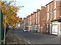
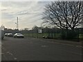
2
Brixton Road, Radford
Two storey plane-fronted terraces like this are not a common sight in Nottingham.
Image: © David Lally
Taken: 15 Mar 2008
0.05 miles
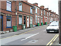
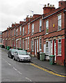
3
Brixton Road, Radford
Much of the Radford area traditionally consisted of red brick Victorian terraced houses occupied by workers at either the Raleigh bicycle factory or Player's cigarettes. Many of the streets were demolished and redeveloped in the 1970s, but Brixton Road - now sporting a fine display of green wheelie bins - has survived.
Image: © Stephen McKay
Taken: 3 Jul 2008
0.05 miles
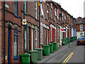
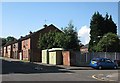
5
Forster Street
These three-storey terraces are typical of Radford, and would have been occupied principally by workers in the textile and tobacco industries in the area.
Image: © Alan Murray-Rust
Taken: 7 Nov 2008
0.06 miles
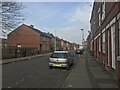
6
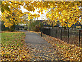
Denman Street West
During 1970s redevelopment this section of the street was converted to a pedestrian walkway, partly to reduce through traffic.
Image: © Alan Murray-Rust
Taken: 7 Nov 2008
0.06 miles
7
Old Radford: Norwood Road
A typical red-brick terrace. In years gone by many of the people who lived here would have worked in the nearby cigarette, cycle and hosiery factories. Parts of Radford were cleared in the 1970s and new houses and flats built.
Image: © John Sutton
Taken: 2 Jun 2015
0.06 miles
8
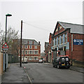
Radford: a grey morning in Croydon Road
The three-strorey building ahead, on the corner of Rifle Street, is now flats, but was originally a pub, The Dover Castle.
Image: © John Sutton
Taken: 12 Apr 2016
0.07 miles
10
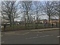
Forster Street: newer houses
These houses replaced the original Victorian ones like those shown in Image Between the trees to the right is the plume from Ratcliffe-on-Soar power station, about seven miles away to the south west.
Image: © John Sutton
Taken: 21 Jul 2012
0.07 miles