IMAGES TAKEN NEAR TO
Nottingham Science & Technology Park, NOTTINGHAM, NG7 2TN
Introduction
This page details the photographs taken nearby to Nottingham Science & Technology Park, NG7 2TN by members of the Geograph project.
The Geograph project started in 2005 with the aim of publishing, organising and preserving representative images for every square kilometre of Great Britain, Ireland and the Isle of Man.

There are currently over 7.5m images from over14,400 individuals and you can help contribute to the project by visiting https://www.geograph.org.uk
Image Map
Images are licensed for reuse under creativecommons.org/licenses/by-sa/2.0
Notes
- Clicking on the map will re-center to the selected point.
- The higher the marker number, the further away the image location is from the centre of the postcode.
Image Listing (206 Images Found)
Images are licensed for reuse under creativecommons.org/licenses/by-sa/2.0
Image
Details
Distance
2
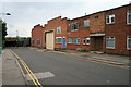
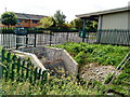
Anonymous Factory
At the foot of Montpelier Road, Dunkirk.
There are no visible remains of any signage, so I have no clue as to what the company was called, or what it did.
Image: © David Lally
Taken: 20 Aug 2008
0.05 miles
3
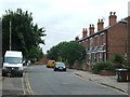
Part of Montpelier Road, Dunkirk, Nottingham
Nice little street of varied homes.
Image: © Jeremy Bolwell
Taken: 25 Nov 2017
0.06 miles
5
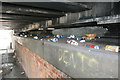
Litter Shelf
Under the Railway bridge between Montpelier Road and Cavendish Street.
Image: © David Lally
Taken: 20 Aug 2008
0.08 miles
6
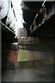
Between Two Bridges
Google maps and maps.live show Montpelier Road and Cavendish Street as continuous. Beware anyone who tries to drive along as, apart from many barriers in the way, the headroom is only about 6 feet.
Image: © David Lally
Taken: 20 Aug 2008
0.08 miles
8
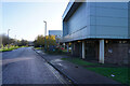
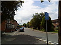
Jesse Boot Avenue
Named after the founder of the Boots pharmaceutical business this avenue is very close to the main Boots factory site.
Image: © Malcolm Neal
Taken: 25 Nov 2022
0.09 miles
9
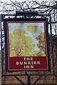
The sign of the Dunkirk Inn
I have no idea what the relevance of this scene is but this has been the sign of this pub since at least 2008 http://www.geograph.org.uk/photo/1054278
Long view of the pub as it is today: Image
Image: © David Lally
Taken: 29 Mar 2017
0.09 miles
10
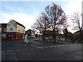
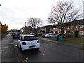
Scene off Montpellier Road, Dunkirk, Nottingham
The Amazing Thai Cafe here and a derelict public house.
Image: © Jeremy Bolwell
Taken: 25 Nov 2017
0.10 miles